Urban Habilitation AutoCAD DWG with Complete City Layout and Plots
Tags
Ratings & Reviews
Be the first to share your experience with this product. Your review helps others make better decisions!
Description
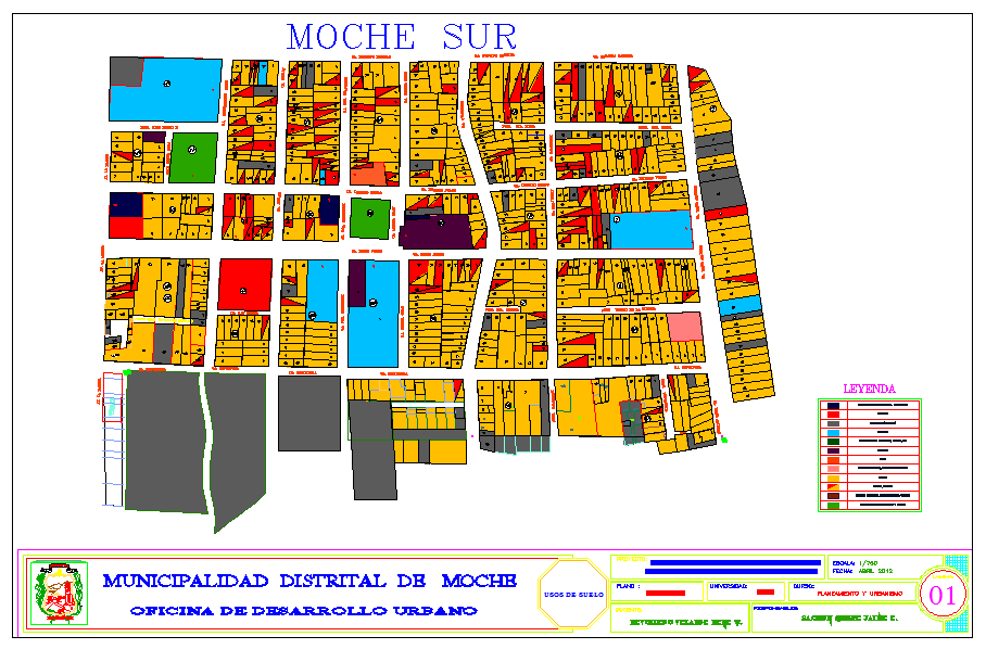
Enhance your urban planning and civil engineering projects with this Urban Habilitation AutoCAD DWG file, designed for detailed city and township layouts. This AutoCAD file includes plot arrangements, street layouts, zoning, and public spaces. All measurements are precisely labeled, allowing architects, civil engineers, and urban planners to integrate them seamlessly into AutoCAD, Revit, 3d Max, and SketchUp for accurate modeling, visualization, and project documentation.
The DWG file features detailed layouts of streets, roads, plots, green spaces, and service areas, providing comprehensive references for urban infrastructure and city development projects. Sectional and plan views ensure precise placement of plots, buildings, and open spaces, delivering professional-quality documentation. Ideal for both educational and professional purposes, this ready-to-use, fully measured DWG file saves time while maintaining accuracy. Subscribe now to access this high-quality AutoCAD DWG file with complete urban habilitation plans, sections, and zoning details to expand your project library with precise, editable, and ready-to-use city layout drawings.

Uploaded by:
Jafania Waxy
Tags
Ratings & Reviews
Be the first to share your experience with this product. Your review helps others make better decisions!