Town Planning Details AutoCAD Drawing with Society Layout Design
Tags
Ratings & Reviews
Be the first to share your experience with this product. Your review helps others make better decisions!
Description
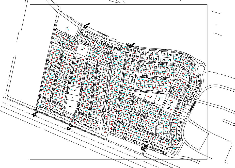
This town planning details an AutoCAD drawing that presents a complete society layout design prepared for residential development planning. The drawing includes plotted layouts with internal road networks, defined plot sizes, junctions, and circulation patterns designed for smooth movement. Parking areas, garden spaces, and common open zones are clearly marked with accurate dimensions to support organized land use. The layout shows proper alignment of plots, road widths, turning radii, and boundary lines, helping planners understand spacing, accessibility, and overall site distribution with precise measurements.
The town planning details DWG file also includes designated areas for public utilities such as school zones, green spaces, and community facilities within the society layout. All elements are drafted to scale with clear annotations, making the drawing suitable for planning approvals, design coordination, and development studies. The AutoCAD DWG format ensures easy modification and compatibility with AutoCAD, 3D Max, Revit, and Google SketchUp. This drawing is ideal for architects, civil engineers, interior designers, and builders who require accurate town planning layouts for residential projects, infrastructure planning, and professional documentation.
Uploaded by:
helly panchal
Tags
Ratings & Reviews
Be the first to share your experience with this product. Your review helps others make better decisions!