Town Planning CAD Drawing Layout with Zoning and Road Details

Ratings & Reviews
Be the first to share your experience with this product. Your review helps others make better decisions!
Description
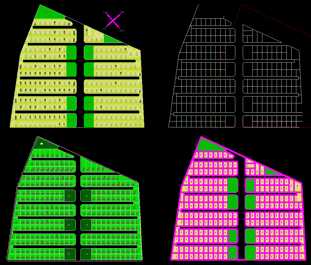
This Town Plan CAD drawing file presents a comprehensive and well-structured urban layout design that includes detailed road networks, zoning divisions, and block arrangements. The drawing features accurately defined plots, open green areas, and public spaces, ensuring efficient land utilization and balanced structure Detail. Each section of the plan is represented with precise measurements and scaling, making it a highly valuable resource for architects, civil engineers, and urban planners involved in city and township development. The layout demonstrates a clear understanding of circulation, zoning, and connectivity, helping professionals visualize the overall flow and distribution of built and open spaces. It is also adaptable for residential, commercial, or mixed-use developments, allowing users to modify the design as per project requirements.
This AutoCAD DWG file serves as a reliable reference for urban design, master planning, and infrastructure projects. It includes road widths, plot divisions, and zoning information essential for professional planning documentation and presentations. The file can also be used as a learning aid for students and researchers studying town planning, civil design, and land-use management. By subscribing to Cadbull, users gain access to an extensive library of professional-quality AutoCAD DWG drawings, including CAD architecture layouts, 3D models, and infrastructure blueprints compatible with AutoCAD, Revit, SketchUp, and 3ds Max.
Tags
Uploaded by:
Harriet
Burrows
Ratings & Reviews
Be the first to share your experience with this product. Your review helps others make better decisions!