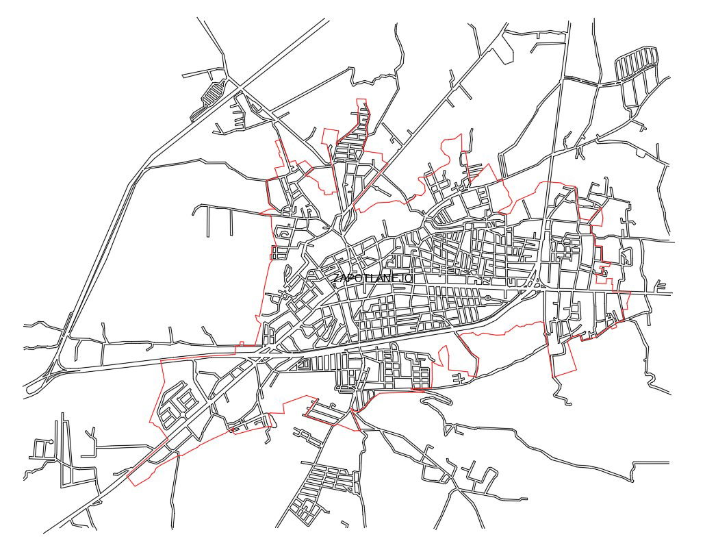
Government Planning Layouts with Area Division Road Network.
Tags
Ratings & Reviews
Be the first to share your experience with this product. Your review helps others make better decisions!
Description
Government planning layout drawing presents complete area-wise division planning for project development, prepared inan accurate AutoCAD format. The plan shows clearly defined administrative boundaries highlighted with perimeter lines and an internal road network distribution across the urban core. Major arterial roads are proportioned approximately 12.00 m to 18.00 m wide, while secondary roads range from 6.00 m to 9.00 m for neighborhood connectivity. The layout identifies central built-up zones, peripheral expansion areas, and structured block patterns for systematic land use control. Area division lines are marked to support phased development and infrastructure coordination.
Uploaded by:
Priyanka Patel
Tags
Ratings & Reviews
Be the first to share your experience with this product. Your review helps others make better decisions!