Mexico City Huge Town Planning Layouts with Land Use Details
Tags
Ratings & Reviews
Be the first to share your experience with this product. Your review helps others make better decisions!
Description
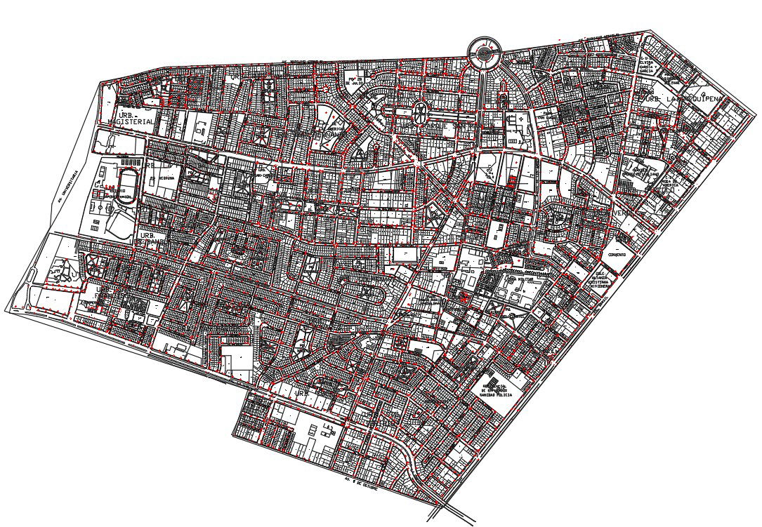
Mexico City Huge Town Planning Layout presents a large-scale urban planning drawing illustrating detailed land use distribution, a structured road network, and organized neighborhood divisions. The plan defines residential zones, commercial blocks, institutional parcels, public facilities, and open spaces clearly marked within the city boundary. Primary arterial roads, secondary streets, and local circulation grids are interconnected to form an efficient urban transport system. Roundabouts, junction nodes, and sector partitions are systematically arranged to support traffic movement and spatial coordination. The drawing reflects dense block formation and mixed land use integration across the Mexico City planning area.
Uploaded by:
Priyanka Patel
Tags
Ratings & Reviews
Be the first to share your experience with this product. Your review helps others make better decisions!