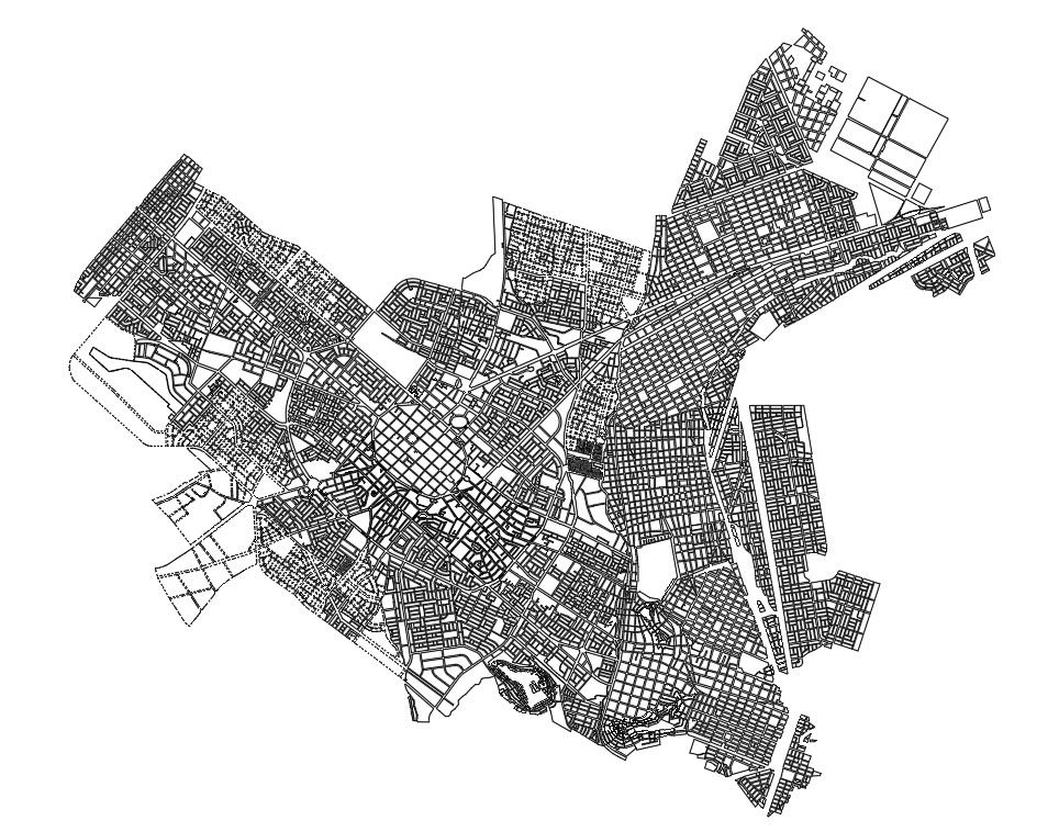
Government Approved Historical City Planning Layout with Road Network
Tags
Ratings & Reviews
Be the first to share your experience with this product. Your review helps others make better decisions!
Description
Government Approved Historical City Planning Layout presents a detailed urban planning drawing prepared under official department supervision. The plan illustrates a structured city layout with dense street grids, radial road connections, and central core development integrated within surrounding expansion sectors. Historic planning patterns are visible through compact block formations and interconnected neighborhood clusters. Major arterial roads, secondary streets, and internal circulation routes are clearly defined to represent systematic traffic movement and land organization. The layout highlights administrative zones, residential sectors, public facilities, and open areas distributed across the planning boundary with precise block segmentation.
Uploaded by:
Priyanka Patel
Tags
Ratings & Reviews
Be the first to share your experience with this product. Your review helps others make better decisions!