Urban Project Commercial Equipment Layout with Influence Radius
Tags
Ratings & Reviews
Be the first to share your experience with this product. Your review helps others make better decisions!
Description
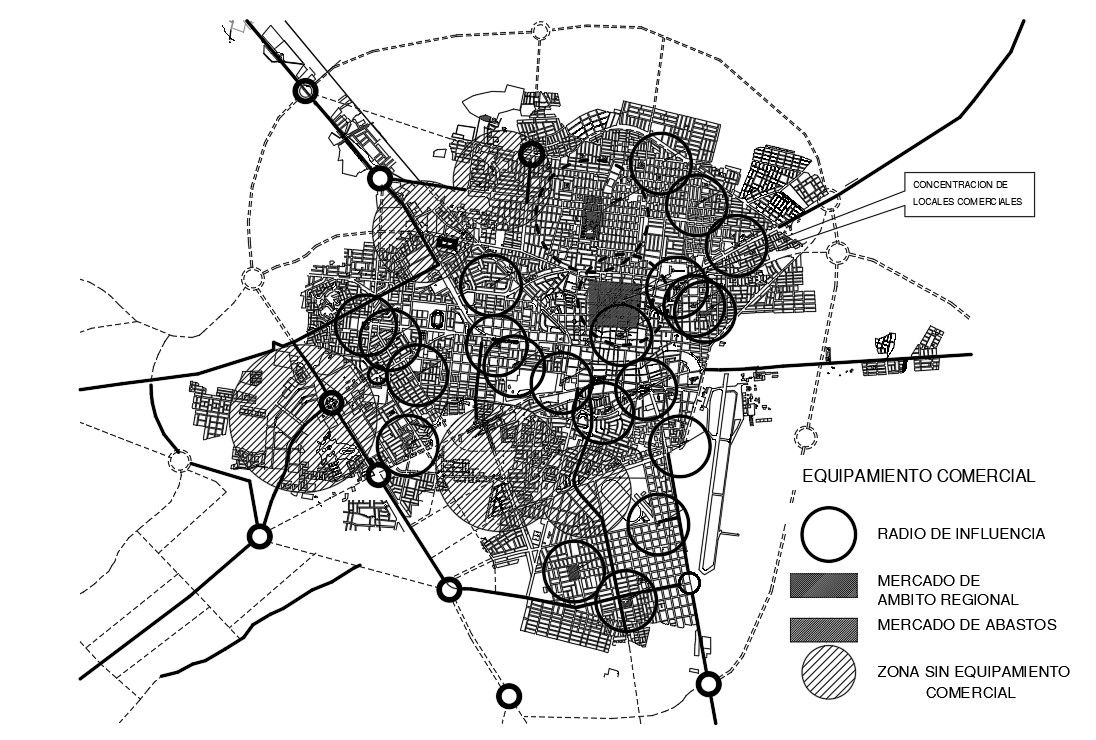
Urban Project Commercial Equipment Layout presents a detailed city planning map illustrating commercial equipment distribution, influence radius zones, and structured urban layout analysis. The drawing highlights the concentration of commercial areas, regional market locations, local market centers, and zones without commercial equipment. Circular influence radius diagrams define service coverage across different neighborhoods and urban sectors. Primary road corridors, secondary connections, and boundary limits are clearly mapped to show accessibility and spatial relationships between commercial nodes and residential districts. The layout reflects historical urban growth integrated with organized market planning and sector-based development strategy.
Uploaded by:
Priyanka Patel
Tags
Ratings & Reviews
Be the first to share your experience with this product. Your review helps others make better decisions!