Urbanization Divide Planning Project DWG File for Tacna City Design
Tags
Ratings & Reviews
Be the first to share your experience with this product. Your review helps others make better decisions!
Description
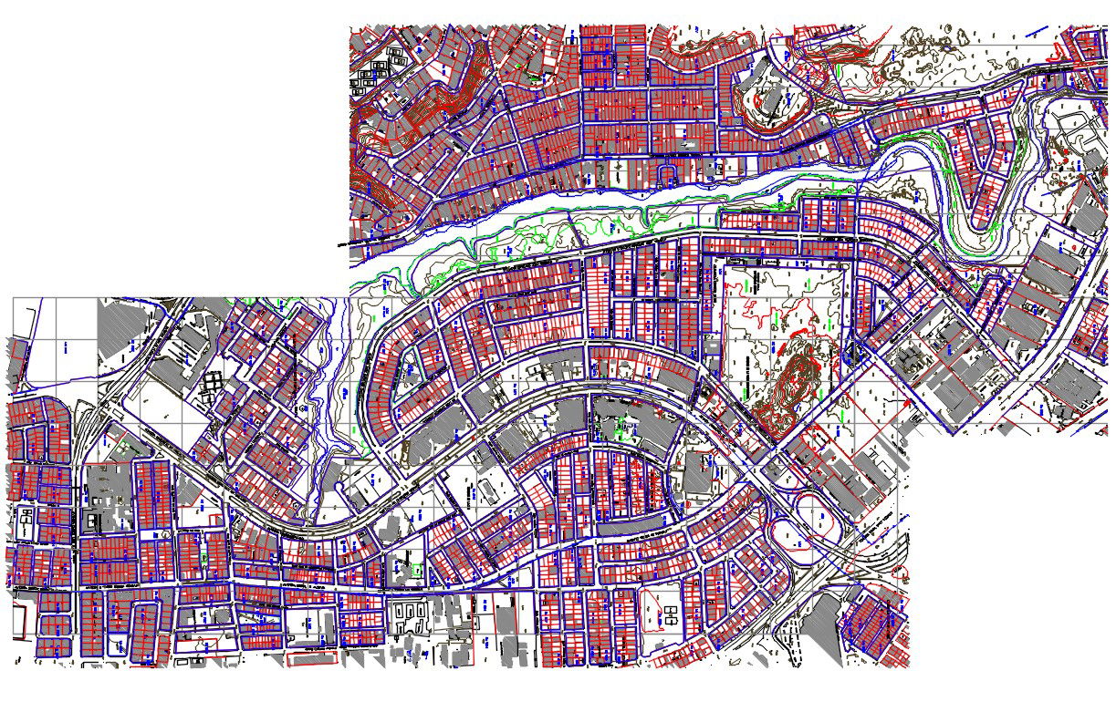
This DWG file features the Urbanization Divide Planning Project for the new Tacna city land. It presents an updated plan for the district, including contour lines, quadrants, and precise measurements for urban development. Designed for architects, civil engineers, and urban planners, the file provides detailed information for the planning and execution of the project. It shows the city’s land division with respect to all areas in the district, helping to visualize the infrastructure layout for urban development. This AutoCAD file ensures that your project is aligned with the city’s updated planning standards.
Uploaded by:
Albert stroy
Tags
Ratings & Reviews
Be the first to share your experience with this product. Your review helps others make better decisions!