Town Urban Planning Detail DWG File for Tarija District Layout
Tags
Ratings & Reviews
Be the first to share your experience with this product. Your review helps others make better decisions!
Description
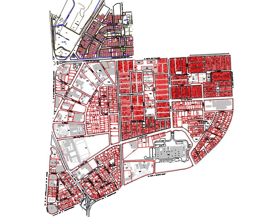
This Town Urban Planning Detail DWG File presents the updated Tarija district layout with clearly defined neighborhoods, district boundaries, and structured land division. The AutoCAD drawing includes detailed street networks, residential blocks, commercial areas, public zones, and infrastructure alignments. Plot segmentation, road hierarchy, junction layouts, and organized zoning are accurately illustrated to support structured town development. The plan reflects systematic land distribution with proper block arrangements and connectivity between districts for balanced urban growth.
Uploaded by:
Albert stroy
Tags
Ratings & Reviews
Be the first to share your experience with this product. Your review helps others make better decisions!