Mountain Society Urban Planning Layout with Zoning Blocks Plan
Tags
Ratings & Reviews
Be the first to share your experience with this product. Your review helps others make better decisions!
Description
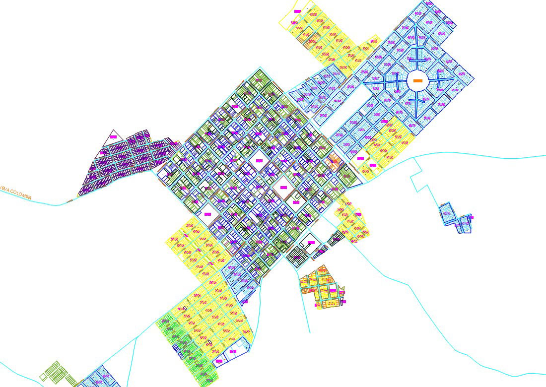
Mountain Society Urban Planning Layout with Zoning Blocks Plan is a detailed AutoCAD DWG drawing presenting a structured urban planning layout designed for mountainous terrain conditions. The plan illustrates a well-defined road network connecting multiple residential plot blocks, circular junction planning, grid-based street alignment, and clearly marked zoning areas for community development. The drawing highlights organized land subdivision, neighborhood clusters, open spaces, and designated development sectors planned according to terrain flow. Road hierarchy, internal circulation, and sector-based distribution are systematically drafted for accurate site implementation and planning analysis in mountain society development projects.
Uploaded by:
Albert stroy
Tags
Ratings & Reviews
Be the first to share your experience with this product. Your review helps others make better decisions!