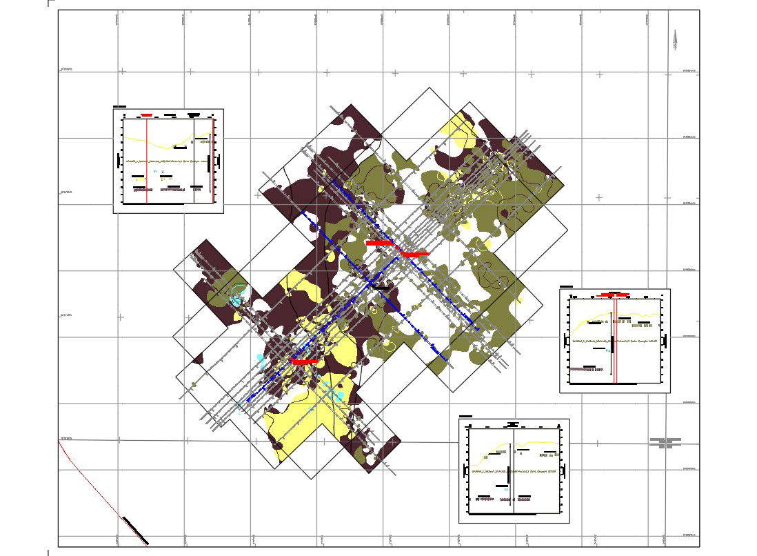
Proposed location of rig site and environmental survey of shallow gas map level 3 were given in this drawing Download the Autocad DWG file.
Ratings & Reviews
⭐
No Reviews Yet
Be the first to share your experience with this product. Your review helps others make better decisions!
★★★★★
Description
Proposed location of rig site and environmental survey of shallow gas map level 3 were given in this drawing. In this file geodetic parameters, positioning by starfix differential gps were given clearly. Gas levels were indicated by the different colors. Other details like boundary area and limit of survey area were mentions in the legend. Thank you for downloading the cad file and other program file from our website.
Tags
#Survey#Geodetic#Boundary
Uploaded by:
Marvel
Ratings & Reviews
⭐
No Reviews Yet
Be the first to share your experience with this product. Your review helps others make better decisions!
★★★★★