Site Plot Design CAD Drawing for Land Survey and Planning Layout
Tags
#site plot CAD#plot layout drawing#land survey CAD#residential plot design CAD#lot dimensions CAD drawing#site planning CAD layout
Ratings & Reviews
⭐
No Reviews Yet
Be the first to share your experience with this product. Your review helps others make better decisions!
★★★★★
Description
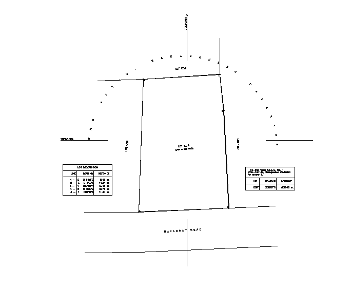
The site plot design CAD drawing presents a detailed layout used for land survey and residential or commercial site planning. This AutoCAD drawing includes plot boundaries, lot dimensions, orientation, and area measurements for accurate site documentation. The drawing helps architects, civil engineers, and urban planners understand land division, alignment, and spatial arrangement for building projects. It supports the preparation of site plans, survey documentation, and construction layouts.
Uploaded by:
Priyanka Patel
Tags
#site plot CAD#plot layout drawing#land survey CAD#residential plot design CAD#lot dimensions CAD drawing#site planning CAD layout
Ratings & Reviews
⭐
No Reviews Yet
Be the first to share your experience with this product. Your review helps others make better decisions!
★★★★★