Map Distance Calculator application. Download the APK files now.
Description
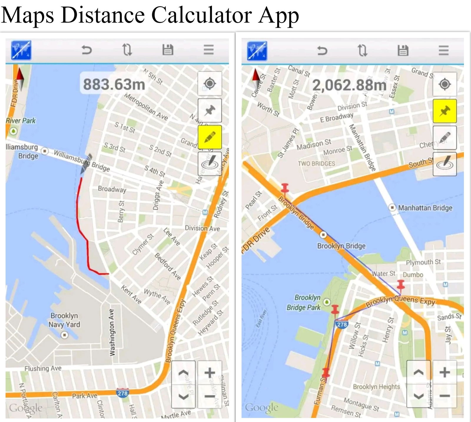
Map Distance Calculator application allows you to measure distances on a map in two ways. Firstly user can place pins on the map and measure the distance between consecutive pins. Secondly, you can measure the continuous path among points by pen tool. To do this user must click on the map to place the pen first then long-pressing on the pen will activate the continuous drawing. Directions & Distance Between Cities is a good app for getting direction on maps. Also, you can calculate the distance between two cities or 2 points. You only need to enter an address then the application will auto direction and route finder for you to go. Same like google goes maps this application best finds a route in real-time. To Calculate the area for land on the map, click on the map less than 3 points. Directions & Distance Between Cities application is free for all features. Thru Voice navigation, Maps will navigate by voice and guide detail step by step go. you will see your current location on the map in real-time. It can track location when you move on the road. To use maps voice navigation features you just need to enter an address or coordinates(latitude and longitude) then search. Then press the voice navigation button from our application. Right away the application will find the best route from your current location to that address. By Using GPS technology for maps. Even though you are anywhere, you only need to turn GPS and enable get the location. The app will auto-process and show your current location on maps. So, you can share your current location to networks social such as Facebook, Instagram, Twitter, zalo, Viber, Line, SMS, email, google plus, WhatsApp. And GPS, Maps, Traffic Alerts & Live Navigation find the route for walking, driving directions, and bicycling. In the location trackers, The current location by the marker is green in color. The other location with a marker point is red color. The dot has blue color is your current location in real-time. In this Support four type maps, you can set them. They are Hybrid maps which are the default, Terrain maps, Satellite maps, Normal maps. The Maps Directions & GPS Navigation Search from two locations anywhere in the world. Our maps will find the route best from location A to B. Then it can calculate the distance and time between them. It also describes detail step by step goes. Free maps when you view model 3D or traffic. You can easily Save location(coordinates – latitude and longitude) in real-time.
Also, you can save your address and your current location then share your location to networks social. And Location tracking also available. Map Distance Calculator application is very useful for Civil engineers, Architects, structural engineers to measure objects easily and fast. It saves their work time. Also, it is very helpful for the people who need to take map distance measurements. Thank you so much for Downloading free Measurement APK files from the cadbull.com website. Download the Apk file for free now.
File Type:
APP
File Size:
3.4 MB
Category::
Advanced Technology
Sub Category::
Mobile App CAD Blocks, Drawings & 3D Models for Design
type:
Free

Uploaded by:
AS
SETHUPATHI

