2D Area Development Layout Drawing for Town Planning Projects
Tags
Ratings & Reviews
Be the first to share your experience with this product. Your review helps others make better decisions!
Description
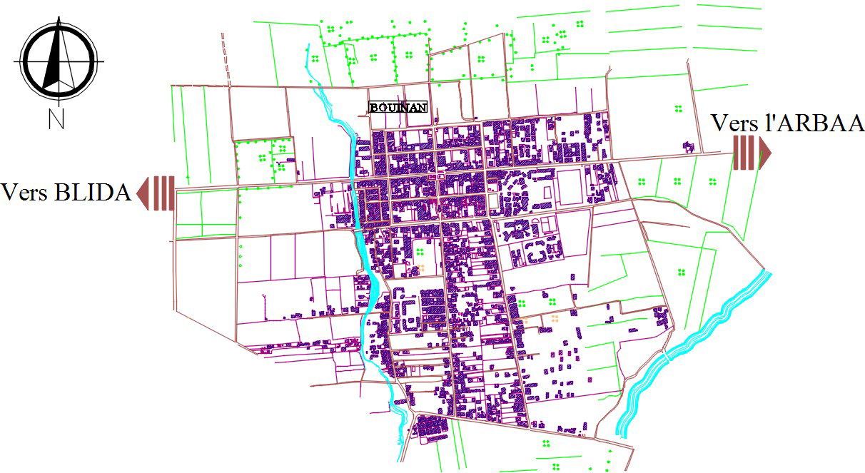
This 2D area development layout drawing is prepared in AutoCAD format and presents a comprehensive planning view suitable for town and urban development projects. The drawing clearly illustrates road networks, plot divisions, built up zones, open land parcels, and natural features such as water channels and surrounding fields. Direction indicators are marked for connectivity reference toward Blida and Arbaa, supporting orientation and planning analysis. The layout uses layered line work and color coding to differentiate residential clusters, circulation paths, and undeveloped areas, making it suitable for detailed planning and documentation purposes.
The area development drawing is ideal for architects, civil engineers, planners, and designers involved in infrastructure and urban layout planning. This AutoCAD DWG file supports accurate spatial understanding of plot distribution, access roads, and surrounding context for development proposals. The 2D planning drawing helps in zoning studies, feasibility assessments, and presentation drawings. The structured layout ensures compatibility with AutoCAD, Revit, 3ds Max, and SketchUp workflows. Accessing this area development CAD drawing through a Cadbull subscription supports efficient planning, modification, and professional project documentation.
Uploaded by:
Pavithra
Tags
Ratings & Reviews
Be the first to share your experience with this product. Your review helps others make better decisions!