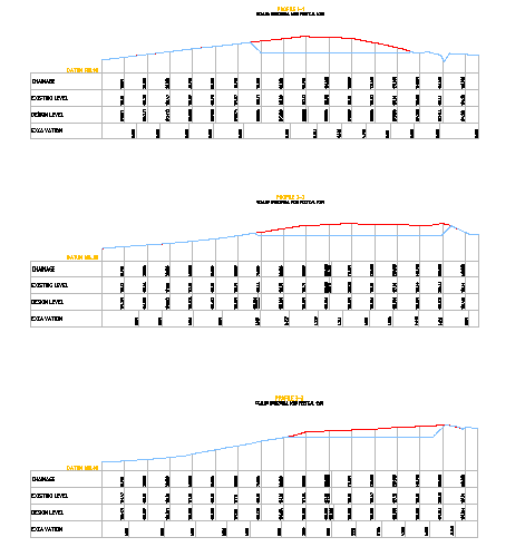
Profile Options DWG Showing Chainage, Elevation, and Excavation Levels
Tags
Ratings & Reviews
Be the first to share your experience with this product. Your review helps others make better decisions!
Description
This AutoCAD DWG file provides detailed profile options for site planning, showing chainage, existing and proposed levels, excavation depths, and elevation data with precise measurements and annotations. The drawing includes multiple profile views for different routes or sections, highlighting ground contours, cut and fill requirements, and slope adjustments to assist civil engineers, surveyors, and planners in accurate design and implementation. Each profile view is clearly labeled with chainage markers, existing surface levels, proposed grades, and excavation dimensions, ensuring clarity and precision for construction documentation and site execution. CAD professionals can visualize, edit, and integrate these profiles into civil, infrastructure, or landscape projects.
Uploaded by:
viddhi chajjed
Tags
Ratings & Reviews
Be the first to share your experience with this product. Your review helps others make better decisions!