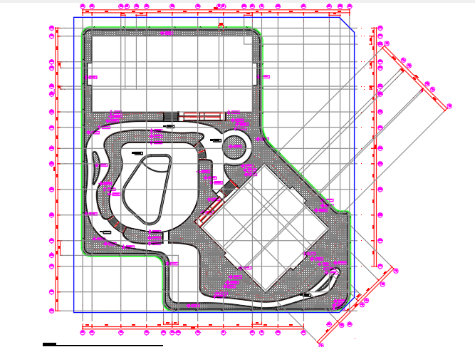
Landscaping Mound Level Detail Drawing With Site Layout And Sections
Tags
Ratings & Reviews
Be the first to share your experience with this product. Your review helps others make better decisions!
Description
Explore the landscaping mound level detail drawing created for precise site grading and landscape planning. This AutoCAD DWG file shows mound elevations, slope gradients, planting zones, pathways, and sectional views with detailed dimensions. Each element is labeled to indicate height levels, material layers, and drainage paths for accurate site execution. Architects, civil engineers, landscape designers, and builders can use this drawing to plan functional and aesthetic mounds, ensure proper water runoff, and coordinate site layouts. The file supports AutoCAD, Revit, 3ds Max, and SketchUp workflows for professional drafting, landscape visualization, and construction planning.
Uploaded by:
viddhi chajjed
Tags
Ratings & Reviews
Be the first to share your experience with this product. Your review helps others make better decisions!