A A Khan Housing Scheme Layout Plan Near Ali Abad Colony Area
Description
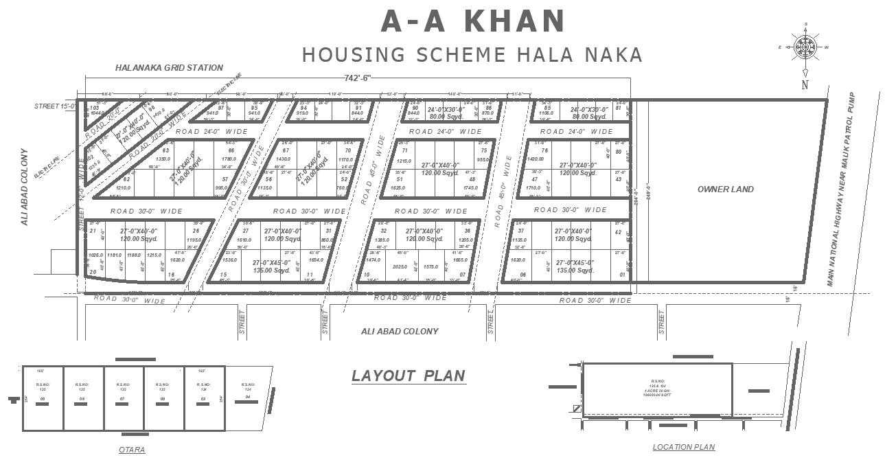
This AutoCAD layout plan illustrates the A A Khan Housing Scheme at Hala Naka near Ali Abad Colony, presenting a well-organized residential development with clearly marked plot divisions and road networks. The drawing includes 27x40 ft plots of 120 sq yds and 135 sq yds, along with 24 ft and 30 ft wide internal roads that ensure smooth circulation throughout the scheme. Plot boundaries, block numbers, street alignments, and surrounding references, such as Ali Abad Colony, grid station, and owner land, are accurately labeled to support site understanding and planning clarity. This housing scheme DWG file is ideal for architects, civil engineers, planners, and builders seeking a reliable reference for residential layout planning, approvals, and execution. The drawing supports site analysis, infrastructure coordination, and plot-level development with precise dimensions and clean drafting standards. Its structured zoning and readable layout help reduce design errors and improve workflow efficiency.
Uploaded by: