Al Mustafa Town Layout AutoCAD Plan with Residential Commercial Plots
Description
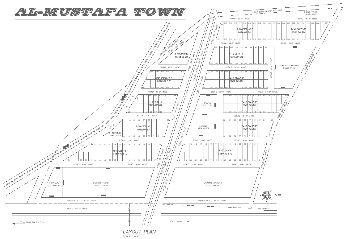
This Al Mustafa Town layout AutoCAD drawing presents a well-organized residential and commercial plot division plan with integrated public amenities. The layout clearly illustrates residential plots measuring 24 feet by 45 feet with an area of 1080 square feet, arranged systematically along 30-foot-wide internal roads for smooth circulation. The site planning includes clearly marked road hierarchies such as 30-foot-wide internal roads, 30-foot-wide service roads, and a major 110-foot-wide approach road, ensuring efficient connectivity throughout the town. Plot numbering, block alignment, and orientation symbols are accurately shown to support precise land subdivision and planning approvals.
The AutoCAD DWG file also highlights essential community facilities, including a hospital area of approximately 11580 square feet, a masjid of about 10876 square feet, multiple school plots measuring around 3985 square feet and 4100 square feet, playground areas of nearly 31000 square feet, and dedicated public park zones. Commercial plots are clearly defined with areas such as 64800 square feet and 63120 square feet positioned along main access roads for better visibility and use. Water course alignment and service access are also marked to provide a full site context. This layout plan is suitable for township development housing schemes and mixed-use urban projects requiring accurate plot measurements and amenity planning.
Uploaded by: