Water Management Housing Society Layout Plan Near Highway With Site
Description
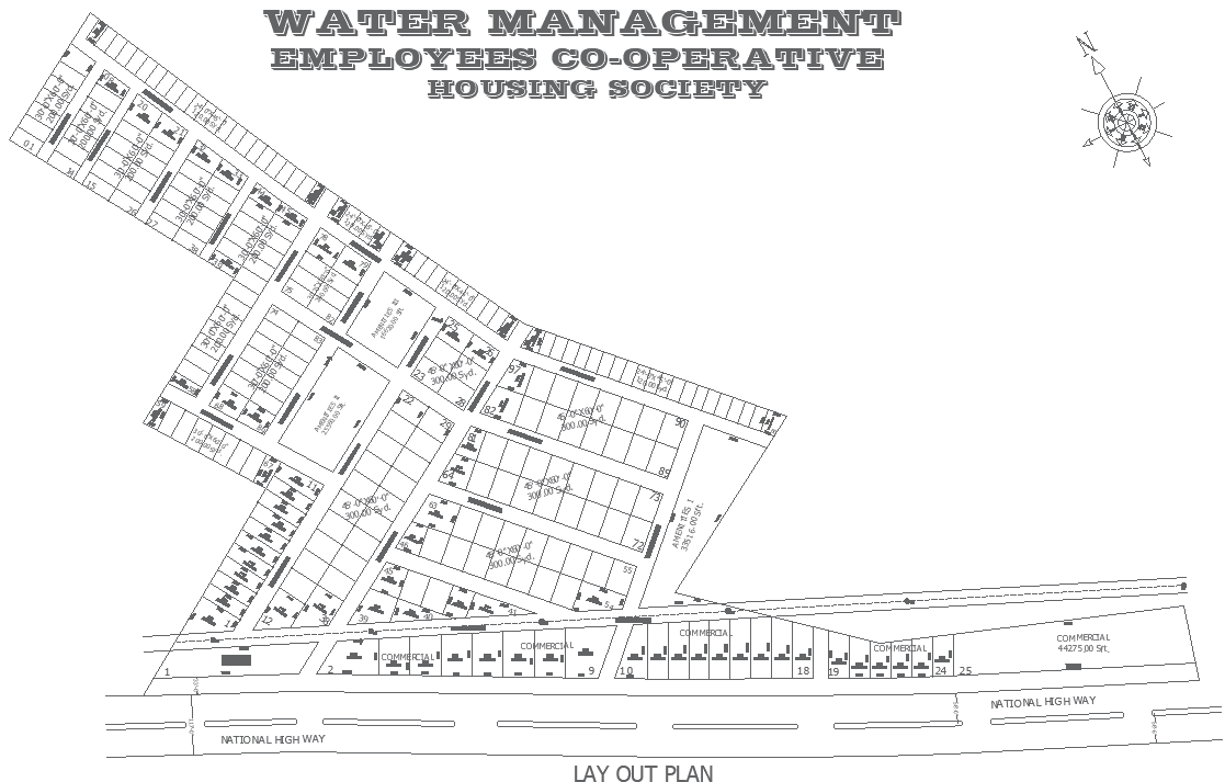
This AutoCAD DWG file presents a detailed water management housing society layout plan designed near a national highway, focusing on efficient land use and organized residential planning. The drawing clearly illustrates plot division with defined plot boundaries, internal circulation roads, and site zoning for residential blocks. Key planning elements such as 9 m wide internal roads, clearly marked plot access, setback lines, and common open spaces are shown to support smooth vehicular movement and safe pedestrian flow. The layout also reflects proximity planning to the highway while maintaining residential safety through buffer zones and controlled entry points.
The drawing further includes site analysis components such as orientation, road connectivity, and space allocation for community use. Residential plots are planned with uniform dimensions to support systematic construction and easy utility alignment. The layout allows architects and engineers to study infrastructure planning, drainage routing, and future service coordination. This DWG file is suitable for architects, civil engineers, urban planners, and builders seeking a reliable reference for cooperative housing projects near major roads. The precise 2D drafting supports accurate estimation, regulatory approval drawings, and efficient project execution using AutoCAD and other CAD-compatible software.
Uploaded by: