Township Layout AutoCAD Plan with 200 Plus Plots and Amenities
Tags
Ratings & Reviews
Be the first to share your experience with this product. Your review helps others make better decisions!
Description
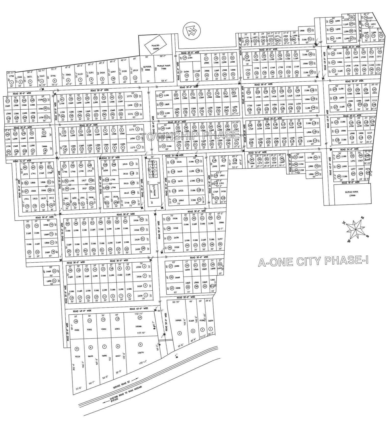
This township layout AutoCAD drawing presents a large-scale residential planning scheme featuring more than 200 plotted units with integrated amenities and road networks. The layout clearly illustrates systematic plot distribution with varying plot sizes such as 1500 sq ft, 1800 sq ft, 2100 sq ft, 2450 sq ft, and larger plots exceeding 3000 sq ft, ensuring flexible residential planning options. Roads are planned in multiple widths, including 24 feet, 30 feet, 40 feet, and wider main access roads to support smooth internal circulation. Each block is clearly numbered with defined boundaries, making the plan suitable for township-level development and land subdivision planning.
The AutoCAD DWG file also highlights essential community amenities,s including a school area, public park space,s and a masjid plot, strategically positioned for accessibility across the township. Open green zones and public parks enhance livability while the structured grid layout supports efficient infrastructure planning. Boundary alignments, orientation symbols, and dimensional annotations are accurately marked for execution clarity. This drawing is ideal for architects, urban planners,s civil engineers, and developers working on large residential township projects. The township AutoCAD plan serves as a reliable reference for housing schemes, mixed residential layouts, and urban expansion projects requiring clear zoning plot measurements and amenity planning.
Uploaded by:
Nilam
Tags
Ratings & Reviews
Be the first to share your experience with this product. Your review helps others make better decisions!