Town Planning Layout with Plot Distribution and Public Amenities
Tags
Ratings & Reviews
Be the first to share your experience with this product. Your review helps others make better decisions!
Description
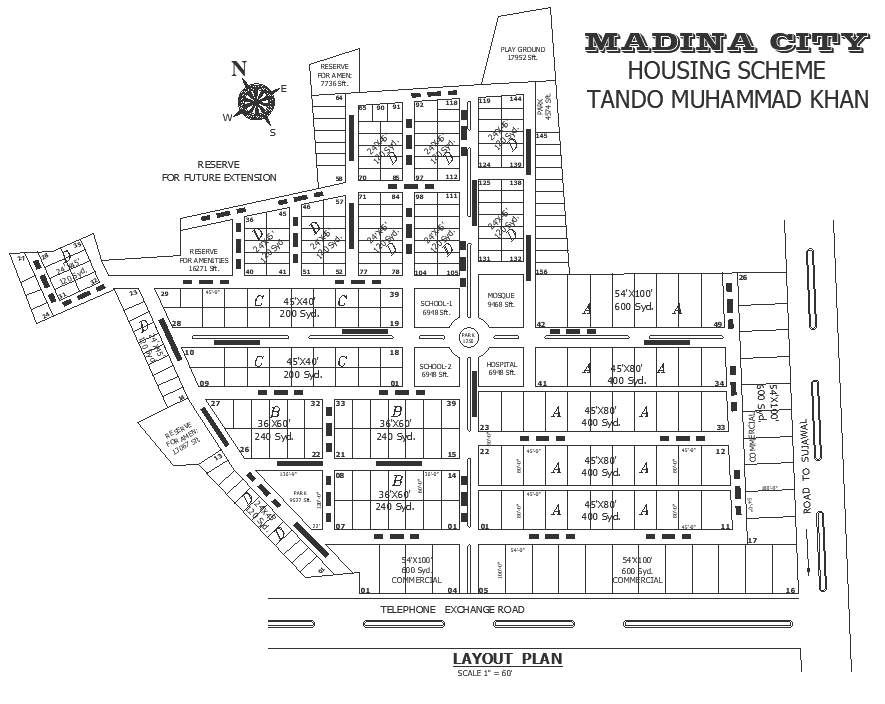
This AutoCAD DWG file presents a detailed town planning layout showing systematic plot distribution along with clearly defined public and commercial amenities. The drawing includes residential plots of varying sizes, internal road networks, main approach roads, commercial blocks, school zones, mosque area, playground, hospital plots, and reserved spaces for future expansion. Plot numbering, plot dimensions, road widths, circulation paths, and zoning boundaries are clearly labeled, ensuring an accurate understanding of land use and planning hierarchy.
This town planning CAD layout is suitable for architects, urban planners, civil engineers, real estate developers, and planning authorities involved in housing schemes and land development projects. The DWG format supports easy editing, measurement extraction, and layer management for approvals, infrastructure planning, and tender documentation. This drawing helps streamline site planning, zoning coordination, and public amenity integration while maintaining professional drafting standards. Available through subscription access, this layout plan supports efficient urban development workflows and provides a reliable base for scalable residential and mixed-use planning projects.
Uploaded by:
Nilam
Tags
Ratings & Reviews
Be the first to share your experience with this product. Your review helps others make better decisions!