Urban Planning Layout Besides Main Road with Plots and Roads
Description
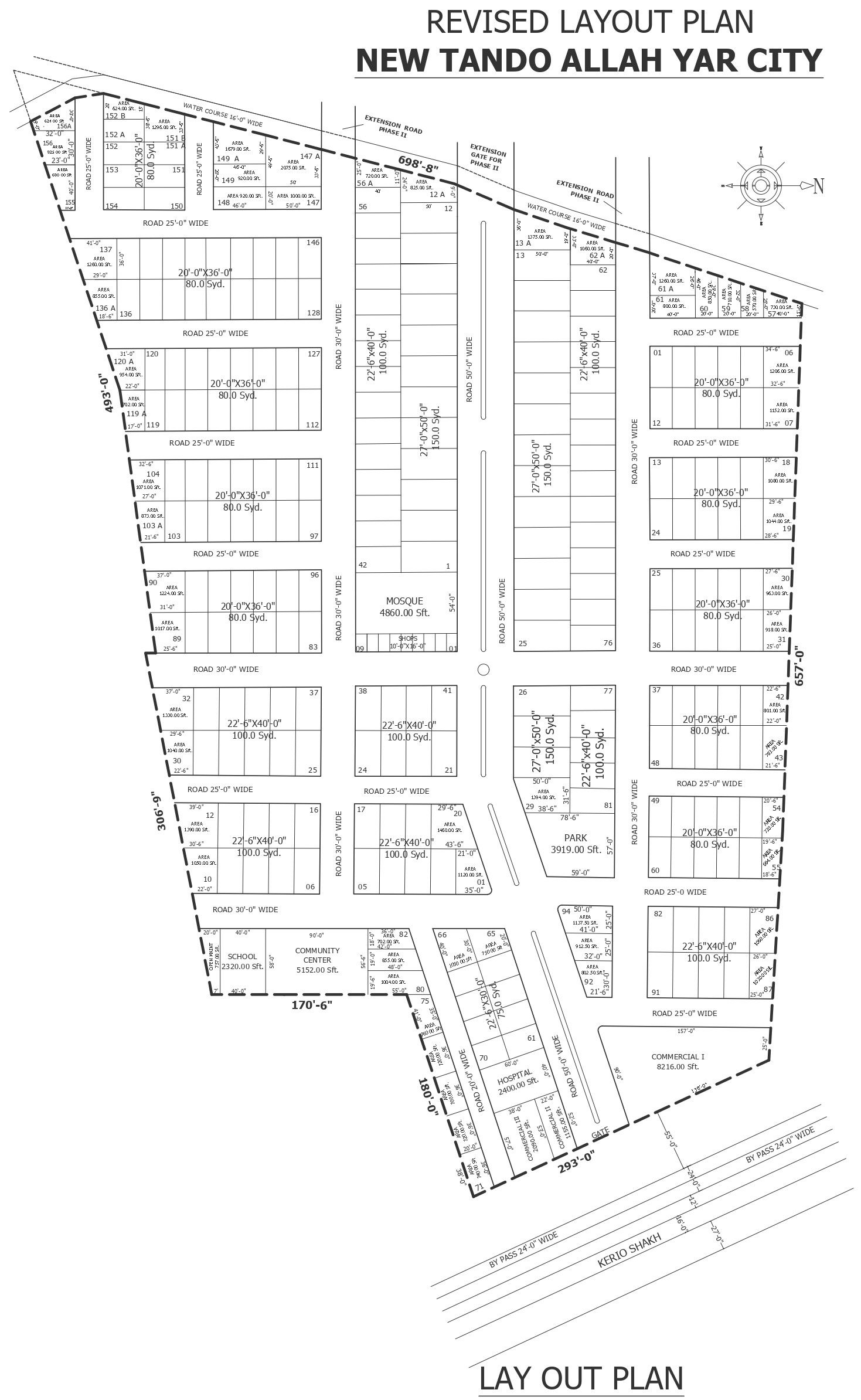
This AutoCAD DWG file presents a revised urban planning layout designed beside a main road, showing a well-organized residential and commercial development scheme. The drawing clearly illustrates plotted housing layouts with standard plot sizes, internal road networks of varying widths, main access roads, and boundary demarcations. Public utility zones, such as a mosque, park, school, hospital, commercial areas, and community center, are precisely positioned to support functional urban living. Plot numbering, plot dimensions, road widths, site boundaries, watercourse alignment, and circulation paths are clearly labeled for accurate planning and execution.
This urban planning CAD drawing is suitable for architects, town planners, civil engineers, and real estate developers involved in layout approvals, master planning, and infrastructure coordination. The DWG format allows easy layer control, measurement extraction, and modification for authority submissions and development proposals. This drawing supports efficient land utilization, zoning clarity, traffic movement planning, and integration of public amenities within residential schemes. Available through subscription access, this file helps streamline planning workflows while maintaining professional documentation standards for urban development projects.
Uploaded by: