Urban Master Plan AutoCAD Layout with Residential Plots Roads and Shop
Description
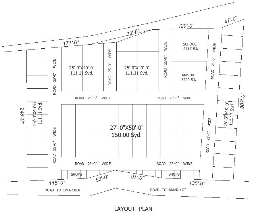
This Urban Planning Master Plan AutoCAD drawing presents a well-organized layout designed for a mixed residential and commercial development. The plan clearly illustrates plotted residential areas, commercial shop zones, institutional spaces, and religious facilities with accurate dimensions and road connectivity. Residential plots are shown in standard sizes such as 25 feet by 40 feet, covering 111.11 square yards, and larger plots of 27 feet by 50 feet measuring 150 square yards. Each plot is arranged along a structured internal road network with uniform 25-foot-wide roads ensuring smooth vehicular movement and efficient access throughout the site. Boundary measurements, including 171 feet 6 inches, 129 feet,t and 307 feet are clearly marked to support precise site planning and land subdivision analysis.
The layout also highlights essential urban amenities, including a school area of 4287 square feet and a masjid space of 3600 square feet, positioned for balanced community access. Commercial shops are aligned along the main road frontage, labeled as the road to Umar Kot, enhancing visibility and commercial value. The drawing focuses on clear zoning, circulation planning, and proportional plot distribution, making it suitable for housing schemes, town planning approvals, and mixed-use developments. This AutoCAD DWG file serves as a reliable reference for architects, civil engineers, planners, and designers seeking accurate urban layout planning with defined measurements and functional land use distribution.
Uploaded by: