Sultan City Housing Layout Plan With 20 Ft Roads And Plot Sizes
Tags
Ratings & Reviews
Be the first to share your experience with this product. Your review helps others make better decisions!
Description
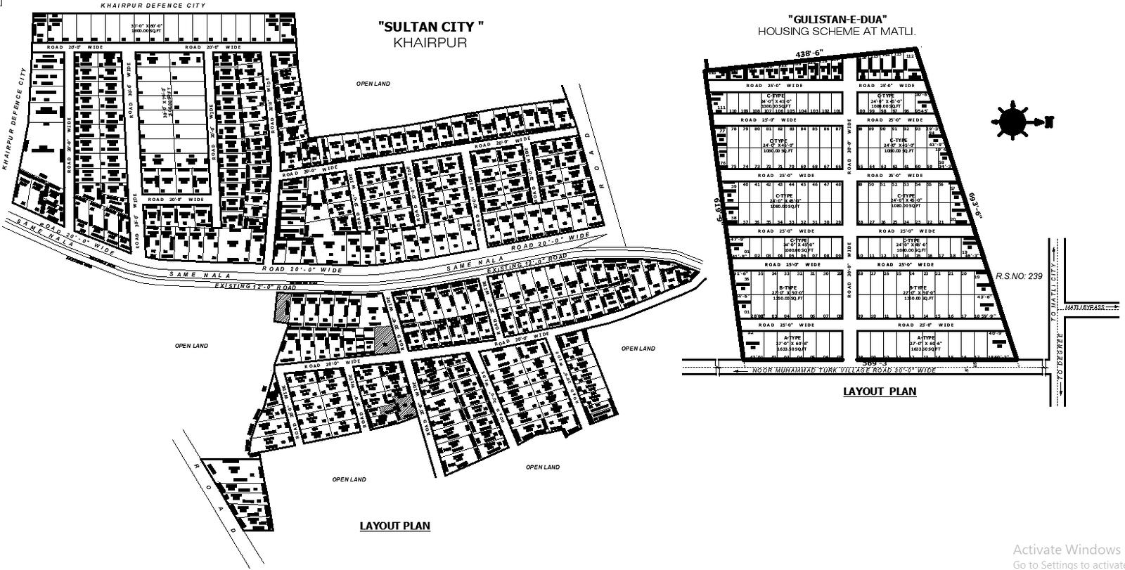
This AutoCAD DWG drawing illustrates a detailed residential housing scheme layout for Sultan City, Khairpur, along with the Gulistan e Dua housing scheme at Matli. The layout clearly presents organized residential plotting with defined plot boundaries, plot numbering, and block arrangements. Residential plots are shown in multiple sizes, including standard plots around 30x60 feet measuring approximately 1800 square feet, and smaller residential plots aligned systematically within each block. Internal road networks of 20 feet in width are consistently marked throughout the layout, ensuring smooth vehicular circulation and proper access to all residential plots. Existing roads of 20 feet width and the same Nala road alignment are also indicated for site connectivity and approach planning.
The drawing further highlights open land areas, demarcation lines, and surrounding land references to support accurate site planning and development understanding. Clear labeling of road widths, plot dimensions, and orientation makes this layout suitable for planning approvals, township development, and construction coordination. The scheme layout AutoCAD DWG file is ideal for architects, civil engineers, town planners, and developers who require accurate residential layout drawings with precise measurements, organized infrastructure, and comprehensive site planning details for urban housing projects.

Uploaded by:
Eiz Luna
Tags
Ratings & Reviews
Be the first to share your experience with this product. Your review helps others make better decisions!