Urban Planning Architecture DWG with Roads Zoning and Land Use
Description
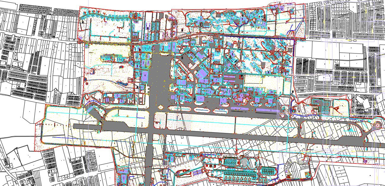
This Urban Planning and Architecture DWG file presents a large-scale development layout showcasing zoning divisions, road networks, land use distribution, and infrastructure alignment. The drawing includes clearly defined sectors, residential plots, commercial zones, and open spaces arranged around primary and secondary circulation routes. The plan highlights road connections to the central corridor, service pathways, grid-based street patterns, and block-level subdivisions that support efficient transportation and accessibility. Various regions are outlined with detailed plot boundaries, building footprints, and urban clusters that form an interconnected masterplan.
Additional layers illustrate drainage paths, contour lines, green belts, pedestrian routes, and utility corridors integrated across the planning area. Dense housing layouts, institutional zones, parking clusters, and landscaped spaces appear throughout the drawing, providing a realistic representation of mixed-use development. The layout supports architects, urban planners, designers, and engineers who require accurate spatial coordination for city planning, land development, and infrastructure studies. This DWG offers a comprehensive visual reference for understanding large-scale urban relationships, supporting both conceptual planning and technical refinement during project execution.
File Type:
DWG
File Size:
22.8 MB
Category::
Urban Design
Sub Category::
Architecture Urban Projects
type:
Gold
Uploaded by:
manveen
kaur