Beach Urban Layout DWG with Coastal Roads Marina Zones and Site Plan
Description
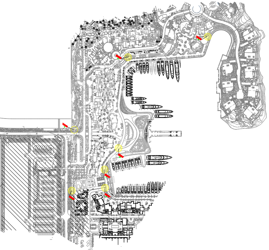
This Beach Area Urban Architecture Layout DWG presents a detailed site plan displaying the full coastal development arrangement. The drawing includes marina docking bays, pedestrian boardwalks, curved coastal roads, landscaped pockets, and resort-style building blocks organized along the shoreline. Multiple circulation loops, parking areas, entry junctions, and internal access streets are mapped with clarity, showing how the coastal district connects its public spaces. The plan also outlines promenades, green belts, service routes, waterfront seating plazas, and structured viewing points along the beach edge. Clustered residential buildings, commercial frontages, and recreational nodes are placed throughout the site, reflecting the layout’s emphasis on layered zoning.
The DWG further highlights grouped amenities such as resort clusters, garden courts, vehicle drop-offs, and yacht parking areas. Dense vegetation zones, transitional slopes, retaining lines, and open landscape areas are also included, helping planners understand the environmental integration of the site. This coastal layout is suitable for architects, civil engineers, and urban planners who require a detailed coastal development reference for circulation analysis, site character studies, and masterplan review. The clear linework and zoning distribution support design evaluation, rendering preparation, and planning workflows in AutoCAD and related modeling tools.
Uploaded by:
manveen
kaur