Smart City Architecture Layout Plan AutoCAD DWG File Download
Description
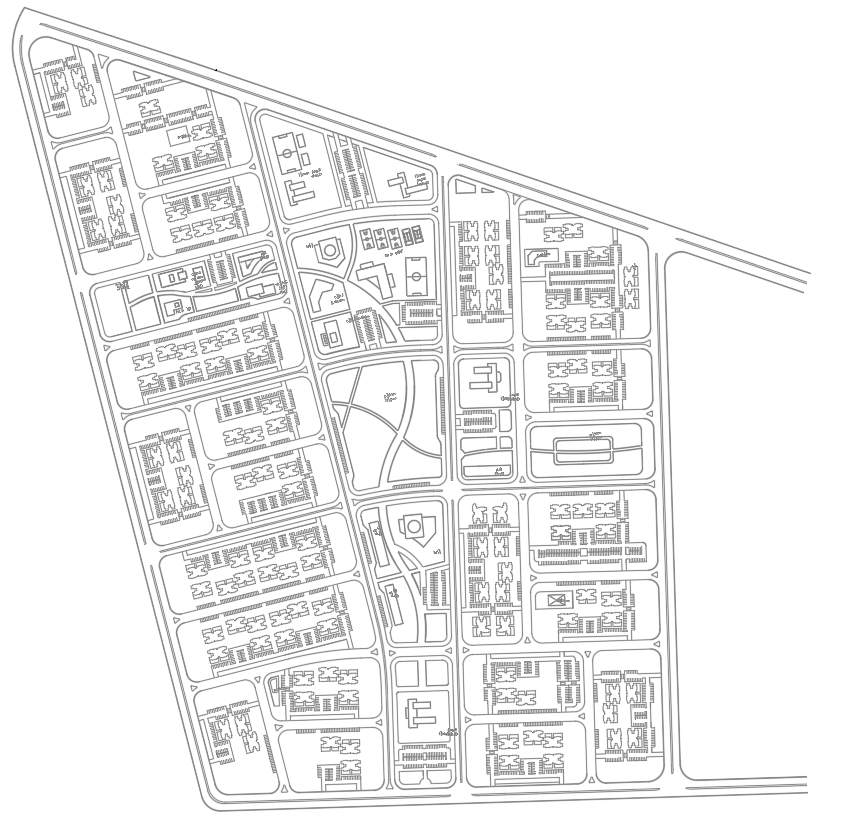
This AutoCAD DWG drawing presents a detailed smart city architecture layout plan, showcasing a complete urban development arrangement with clearly defined residential blocks, commercial plots, educational areas, and recreational zones. The site planning illustrates symmetrical block arrangements, internal road networks, parking allocations, and pedestrian movement pathways. The drawing also includes open green spaces, public amenities, and interconnected circulation routes that support efficient land use. Every building cluster is precisely outlined, offering a comprehensive view of the city grid, zoning structure, and functional planning.
The layout further highlights organized street patterns, access roads, and boundary alignments designed for smooth mobility. The central landscaped zones, community facilities, and structured building footprints help planners, architects, and developers analyze space utilization effectively. This DWG file serves as a useful reference for smart city development, township planning, and large-scale urban design projects. The clean linework, balanced zoning, and detailed block arrangement make the drawing a valuable resource for conceptual planning, presentation layouts, or preliminary design stages of modern urban projects.
Uploaded by:
manveen
kaur