Architecture Town Planning Layout with Road Network and Zoning
Description
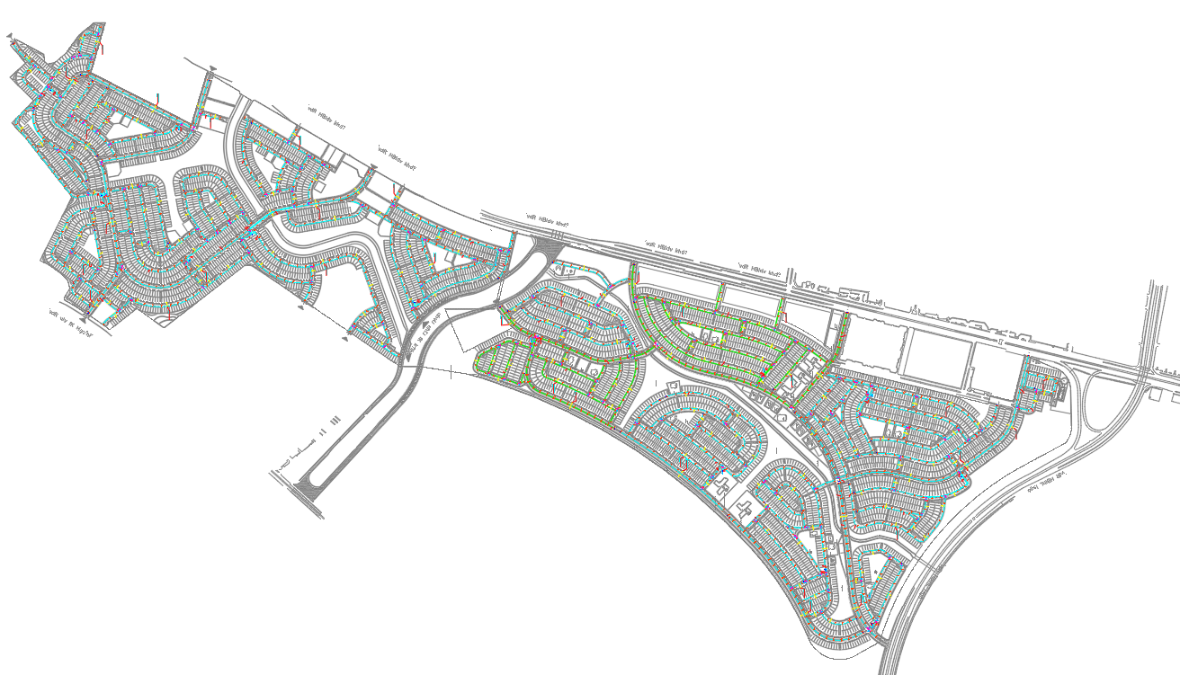
This architecture town planning layout presents a detailed, large-scale urban development design, showcasing interconnected residential zones, commercial pockets, and continuous road networks. The drawing highlights curved and linear streets, block arrangements, cul-de-sac patterns, plot distributions, and green buffers. Each cluster is organized with clear circulation routes and accessible pedestrian links. The road widths vary across main corridors, secondary streets, and internal lanes, ensuring efficient movement and balanced traffic flow. Zoning is visually separated, allowing planners to understand block capacity, land use mix, and open space distribution across the layout.
The plan also includes infrastructure components such as utility routes, service corridors, and integration points connecting to the major highway shown at the upper boundary. Key entrances, turning loops, community zones, and landscape strips are marked throughout the drawing, helping planners analyze development density and connectivity. The detailed plot patterns support urban design studies, neighborhood planning, and phased development proposals. This CAD file is ideal for architects, urban planners, engineers, and developers working on residential township planning, infrastructure mapping, or municipal layout approvals. With accurate road geometry and well-defined sector divisions, it serves as a reliable reference for large-scale master planning.
File Type:
DWG
File Size:
16.1 MB
Category::
Urban Design
Sub Category::
Town Design And Planning
type:
Gold
Uploaded by:
manveen
kaur