High Rise Building Town Planning Architecture Layout Plan Drawing
Tags
Ratings & Reviews
Be the first to share your experience with this product. Your review helps others make better decisions!
Description
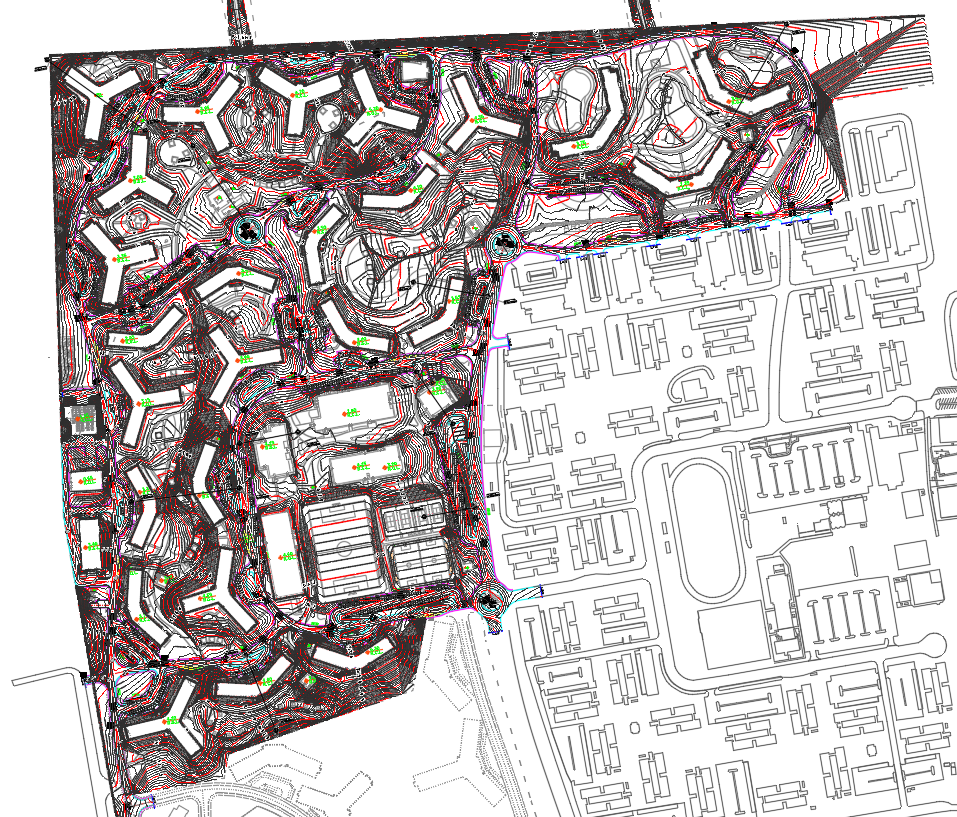
The High Rise Building Town Planning Architecture Layout Plan is a detailed AutoCAD DWG file prepared for large-scale urban and residential development projects. This drawing clearly shows the overall site layout with multiple high-rise building blocks positioned according to contour levels and land formation. It includes road networks, internal circulation paths, zoning boundaries, plot distribution, and building footprints arranged as per town planning standards. Contour lines, level markings, and terrain detailing are provided to support proper site grading and structural coordination. The layout helps in understanding spatial planning, density distribution, and the relationship between built and open spaces.
This high-rise town planning layout drawing is useful for architects, urban planners, civil engineers, and developers working on master planning and infrastructure projects. The DWG file supports zoning analysis, urban design proposals, and preliminary structural planning. It can be easily edited and integrated into AutoCAD, 3d Max, Revit, and SketchUp workflows for further design development. With accurate planning data, road alignment, and building arrangement, this drawing serves as a professional reference for high-rise residential and mixed-use development projects. The file is available through a Cadbull subscription for advanced architectural and town planning needs.
Uploaded by:
manveen kaur
Tags
Ratings & Reviews
Be the first to share your experience with this product. Your review helps others make better decisions!