Topographic Survey Map with Contours and Site Layout in DWG File
Description
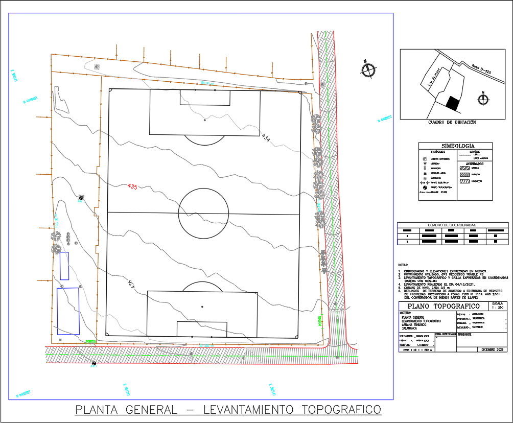
This detailed AutoCAD DWG file presents a complete topographic survey map featuring contour lines, elevation references, site boundaries, and coordinated points for field verification. The drawing includes a full football field layout with goalpost areas, center circle positioning, and perimeter markings. Each contour line is clearly labeled with elevation values such as 433 and 434, helping engineers understand site slope, drainage patterns, and grading conditions. The map also shows trees, utility elements, boundary fencing, access paths, and terrain features essential for planning earthworks and site preparation.
The right-side panel provides symbology, coordinate tables, section references, and a location diagram that identifies the project’s position relative to nearby roads. The topographic sheet includes notes regarding measurement methods, coordinate accuracy, and survey procedures. This DWG file is ideal for civil engineers, surveyors, planners, and landscape designers who need precise land-form information for design development, leveling, and infrastructure assessment. The drawing allows users to analyze slopes, evaluate construction feasibility, and integrate the existing terrain into upcoming architectural or sports-facility projects.

Uploaded by:
Eiz
Luna