Topographic Survey Map with Infrastructure Symbols CAD File
Tags
#topographic survey with utility mapping#civil engineering terrain analysis#infrastructure symbols on topographic map#topographic map#civil engineering#land development.
Ratings & Reviews
⭐
No Reviews Yet
Be the first to share your experience with this product. Your review helps others make better decisions!
★★★★★
Description
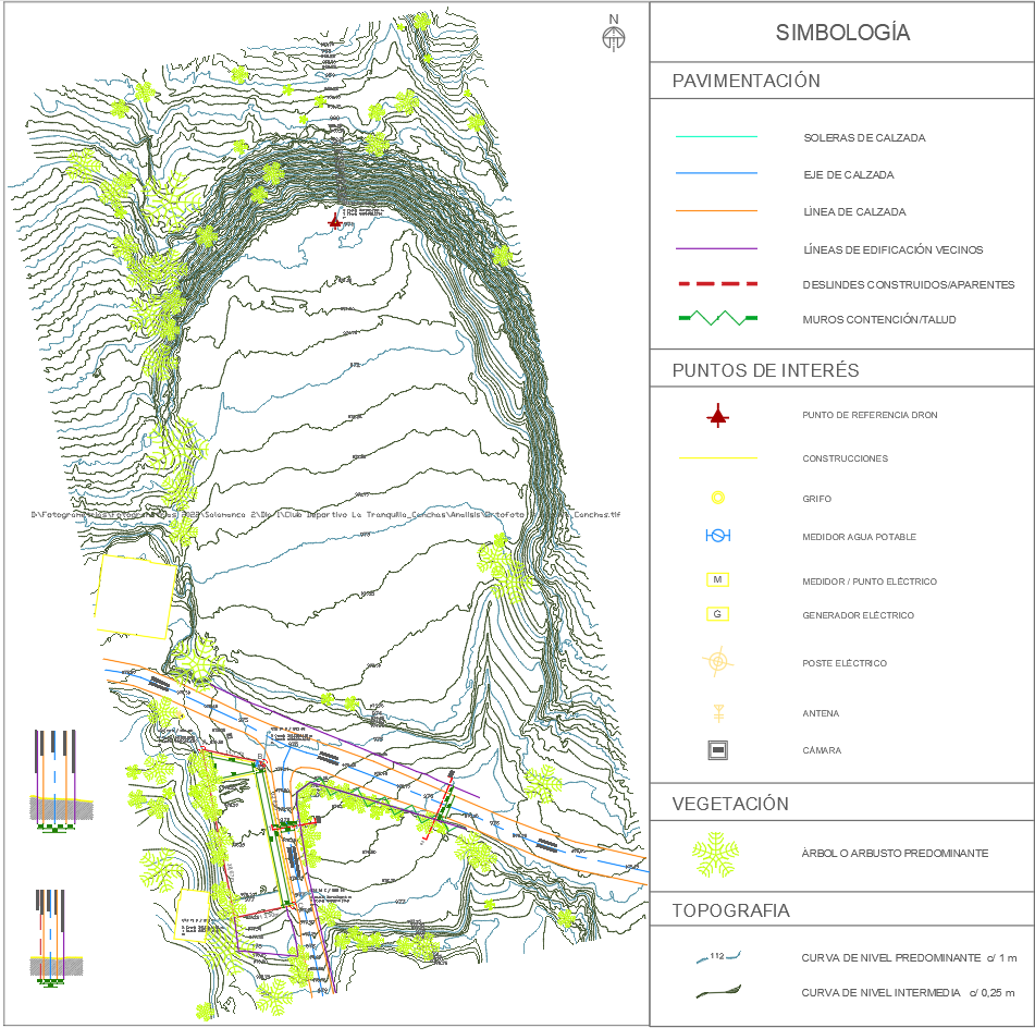
This detailed topographic survey map highlights elevation contours, vegetation, and essential infrastructure elements such as water meters, electric poles, and roadways. It includes a comprehensive legend for interpreting paving, construction boundaries, and topographic levels, making it ideal for civil engineering and land development planning.

Uploaded by:
Eiz Luna
Tags
#topographic survey with utility mapping#civil engineering terrain analysis#infrastructure symbols on topographic map#topographic map#civil engineering#land development.
Ratings & Reviews
⭐
No Reviews Yet
Be the first to share your experience with this product. Your review helps others make better decisions!
★★★★★