Urban Infrastructure Layout with Roads in AutoCAD File

Ratings & Reviews
⭐
No Reviews Yet
Be the first to share your experience with this product. Your review helps others make better decisions!
★★★★★
Description
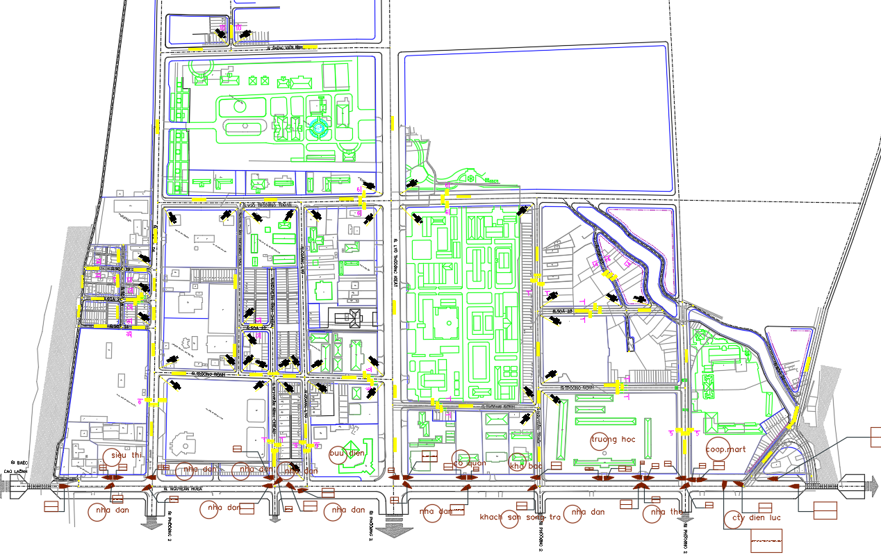
This urban infrastructure layout plan illustrates detailed road networks, utility zones, and public service areas like schools, supermarkets, and residential housing. Designed for smooth access and zoning efficiency, the map supports smart planning for future urban development and optimized city living.
Tags
#urban infrastructure zoning layout#city planning with utilities map#detailed public facilities road plan.
Uploaded by:
Eiz
Luna
Ratings & Reviews
⭐
No Reviews Yet
Be the first to share your experience with this product. Your review helps others make better decisions!
★★★★★