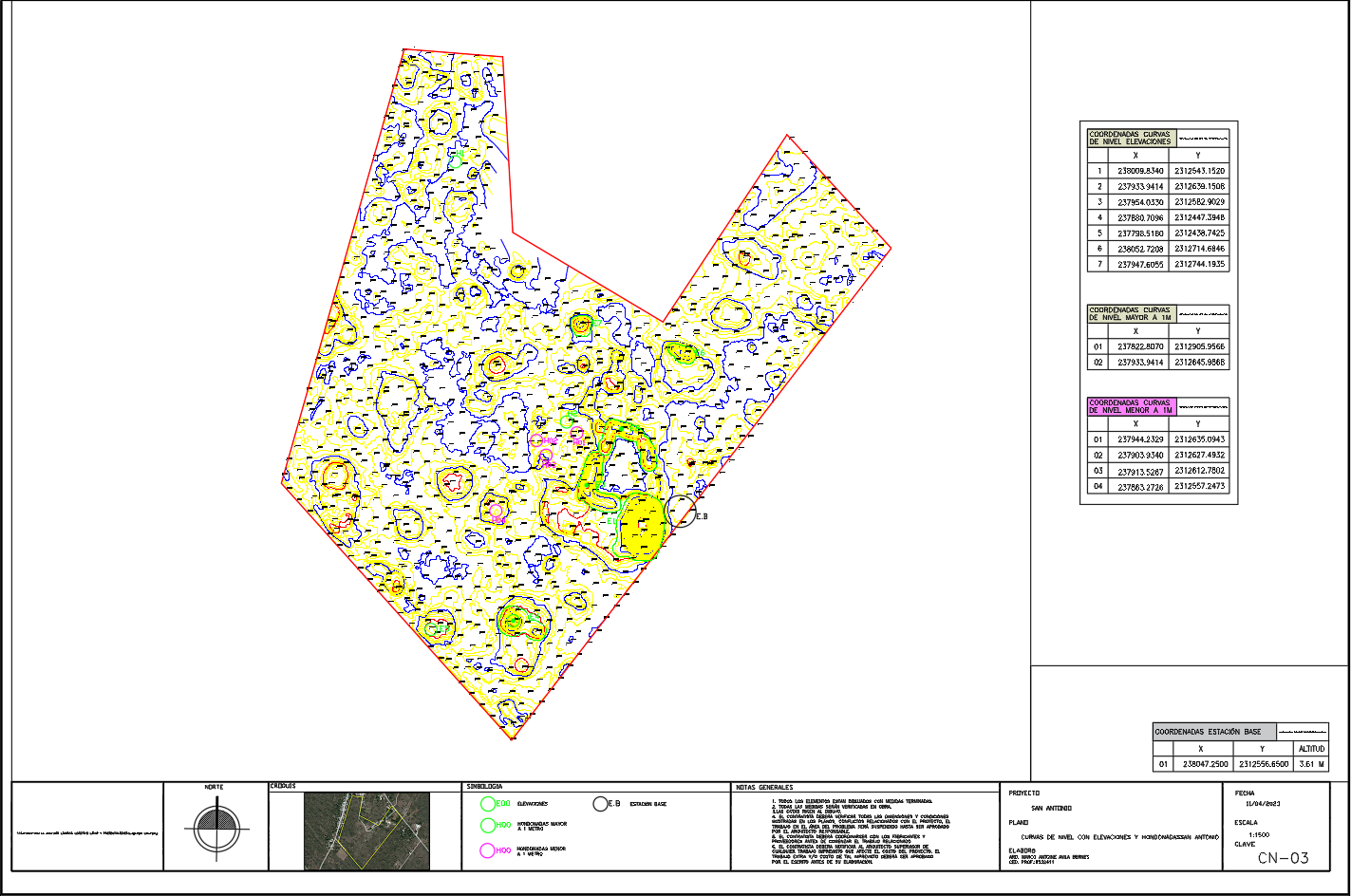
Topographic Survey Contour Map DWG CAD Files
Description
Download topographic survey DWG CAD files with contour lines, elevations, hydrological zones, and coordinate tables for site planning and land development.

Uploaded by:
Wang
Fang
Uploaded by:
Fang