Horizontal Directional Drilling Utility Route Layout Plan Detail
Tags
Ratings & Reviews
Be the first to share your experience with this product. Your review helps others make better decisions!
Description
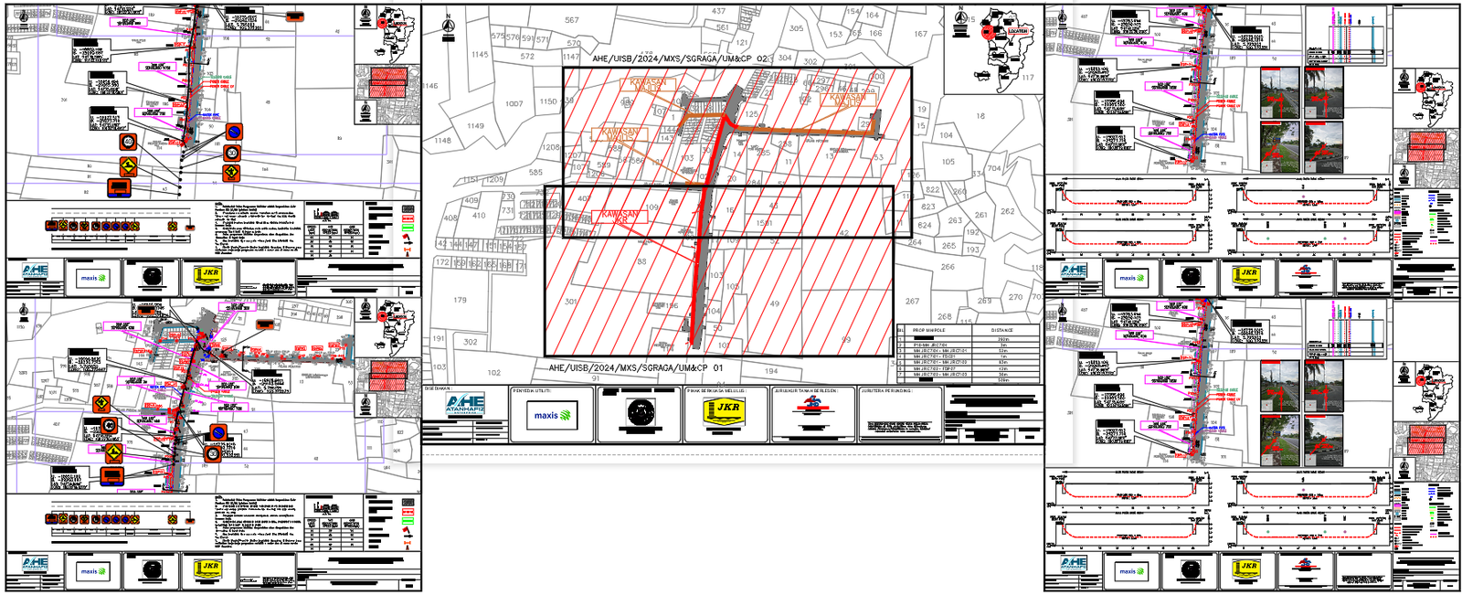
The horizontal directional drilling utility route layout drawing presents a detailed plan showing underground utility alignment and route planning across a defined site area. This horizontal directional drilling utility route layout includes marked drilling path lines with directional arrows indicating the flow of the utility route through plotted land parcels. The drawing illustrates property boundaries, road alignment, and plotted grid references that define the drilling path location. Multiple layout views are included, showing route positioning along different segments with connection points, utility crossings, and directional changes. The plan also highlights warning symbols, traffic signs, and safety indicators positioned along the route to represent site control measures during drilling operations. This horizontal directional drilling utility route layout supports infrastructure planning and underground utility mapping using AutoCAD files and cad files for engineering and construction projects.

Uploaded by:
Harriet Burrows
Tags
Ratings & Reviews
Be the first to share your experience with this product. Your review helps others make better decisions!