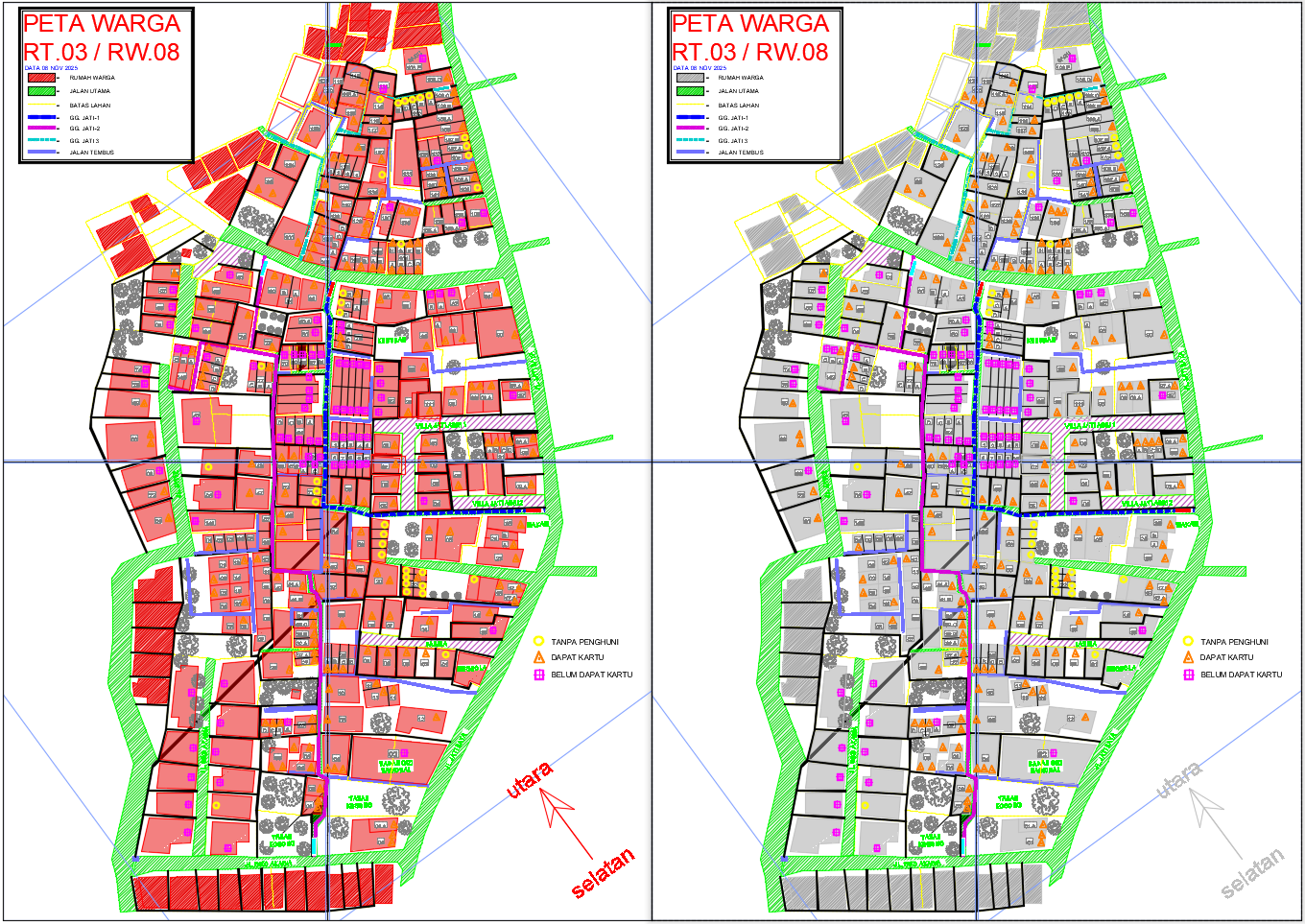
Residential Map Plan RT03 RW08 with Plot Layout and Area Details

Ratings & Reviews
Be the first to share your experience with this product. Your review helps others make better decisions!
Description
This AutoCAD map drawing presents the complete Peta Warga RT03 RW08, showing a dense residential neighborhood with clearly marked house blocks, access routes, and community facilities. The layout includes major connecting roads such as JL Jati Raya, JL Jati 2, and JL Siko Akasia, forming the main circulation corridors across the settlement. Internal pathways like GG Jati 1, GG Jati 2, and GG Jati 3 are highlighted in color-coded lines, providing a structured view of smaller routes linking each housing cluster. The drawing displays hundreds of individually numbered residential units, including plot identifiers such as 11, 12, 17A, 17B, 41A, 41B, 97A, 105A, 108A, 136A, and more, ensuring complete clarity of plot distribution. Public facilities, including Mushola, Badan Gizi Nasional, Tanah Kosong areas, and Maka, are marked within the map, giving architects and planners a detailed understanding of zoning and land use.
The map also visualizes community status using three distinct symbols for Tanpa Penghuni, Dapat Kartu, and Belum Dapat Kartu, helping users analyze occupancy conditions at a glance. Boundary and dimensional references such as 8740, 8961.08, 8674.06, 5589.72, 11000.86, 6644.75 are included to support accurate land evaluation. The shaded land borders, clearly drawn roads, vegetation symbols, and structured block patterns make this DWG mapping highly suitable for urban planning, settlement documentation, and redevelopment assessment. This detailed layout provides precise spatial insight for architects, civil engineers, and urban planners working on community-level planning
File Type:
DWG
File Size:
10.2 MB
Category::
Urban Design
Sub Category::
Town Design And Planning
type:
Gold
Tags
Uploaded by:
Niraj
yadav
Ratings & Reviews
Be the first to share your experience with this product. Your review helps others make better decisions!