Industrial Site Plan with Elevation Levels and Utility Layout Map

Ratings & Reviews
Be the first to share your experience with this product. Your review helps others make better decisions!
Description
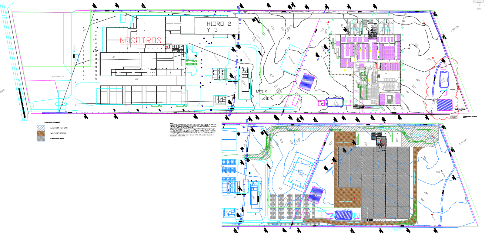
This AutoCAD DWG drawing shows a complete industrial site layout with clearly defined functional zones and terrain information. The plan includes key areas such as Casino, Multicancha, Piscina Riles, Pasarela Peatonal, Galpón, Puentes, Estacionamientos, GAS sector, and Planta Elevadora, all arranged with precise boundary lines and access routes. The layout also highlights a wide series of Cota Fondo elevation points, including 317.10, 317.65, 318.23, 316.95, 316.62, 315.81, 314.98, 314.69, 314.48, 318.74, 319.20, and others that indicate ground levels, slope conditions, drainage flow, and excavation depths across the entire site. Multiple C.I. inspection points, grifos, canal directions, and numerous calicatas are shown, helping to identify underground utilities, water lines, and soil study locations within the project area. The site plan also displays transportation and connection routes such as Camino Público J-310 and Ruta 5, marking perimeter access and entry points to the property. Hydrological flow is represented through directional arrows along the canal system, while the detailed arrangement of structures and service lines outlines operational circulation throughout the industrial area. Zoning elements, utility pathways, building footprints, and landscape contours are all presented with clear linework, measurements, and labels, offering a complete overview of site conditions, infrastructure components, and functional distribution within the mapped area
Tags
Uploaded by:
Niraj
yadav
Ratings & Reviews
Be the first to share your experience with this product. Your review helps others make better decisions!