Road Utility Pipeline Route Layout Plan AutoCAD DWG Drawing Detail

Frequently Asked Questions
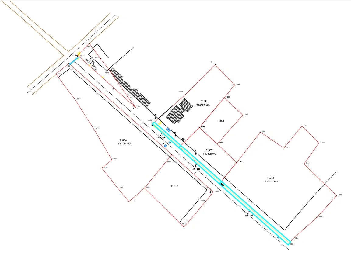
This drawing includes underground pipeline routing, property boundary lines, road alignment references, plot numbers, and service route planning details.
Ratings & Reviews
Be the first to share your experience with this product. Your review helps others make better decisions!
Description
Road utility pipeline route layout plan AutoCAD DWG drawing detail showing a complete underground service line alignment passing through multiple plotted land parcels with marked property boundaries and roadway references. This engineering drawing includes a clearly defined pipeline route with turning connection points, alignment markers, access references, and plot identification including P.536, P.537, P.564, P.565, P.567, and P.641. The layout presents accurate road edge coordination, service line placement, and site utility planning for infrastructure development and land routing. This AutoCAD DWG file is useful for architects, civil engineers, builders, infrastructure planners, AutoCAD users, Revit professionals, 3d Max designers, and Google SketchUp users working on utility network and site development drawings.
Tags
Uploaded by:
Wang
Fang
Frequently Asked Questions
This drawing includes underground pipeline routing, property boundary lines, road alignment references, plot numbers, and service route planning details.
Ratings & Reviews
Be the first to share your experience with this product. Your review helps others make better decisions!