Topographic Urban Planning and Civil Engineering DWG Layout Plan

Frequently Asked Questions
This drawing includes contour mapping, road layouts, drainage lines, plot divisions, terrain elevation references, and boundary planning for site development.
Ratings & Reviews
Be the first to share your experience with this product. Your review helps others make better decisions!
Description
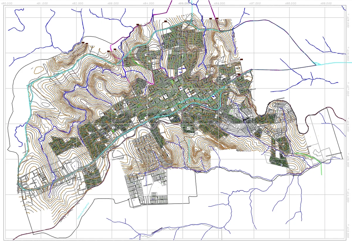
Topographic urban planning and civil engineering DWG layout plan showing a complete land development drawing with contour mapping, road network layout, plot divisions, terrain elevation references, drainage flow channels, and infrastructure planning. This detailed AutoCAD DWG drawing presents contour lines throughout the entire site with clearly organized roadway connections, residential and commercial plot layouts, natural stream paths, and accurate boundary mapping. The drawing highlights topographic elevation changes and terrain contour coordination for large-scale urban planning and civil engineering projects. Suitable for architects, civil engineers, builders, urban planning consultants, AutoCAD users, Revit professionals, 3d Max designers, and Google SketchUp users working on township development, contour analysis, infrastructure planning, and detailed land development documentation.
Tags
Uploaded by:
Wang
Fang
Frequently Asked Questions
This drawing includes contour mapping, road layouts, drainage lines, plot divisions, terrain elevation references, and boundary planning for site development.
Ratings & Reviews
Be the first to share your experience with this product. Your review helps others make better decisions!