Accurate Town Planning AutoCAD DWG with Master Layout and Plot Design
Description
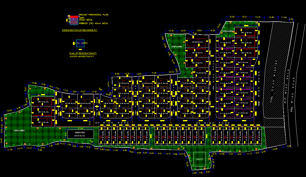
This Town Planning AutoCAD DWG drawing provides an accurately detailed master layout plan designed for effective residential and community development. The drawing includes well-planned plots, road networks, open spaces, amenities, and percolation pits for water harvesting. The site layout features proper zoning and plot dimensions, ensuring efficient land use and smooth vehicular circulation. The plan also integrates open green areas, public utility zones, and a systematic drainage layout, promoting sustainable and organized urban design.
This AutoCAD DWG file serves as a valuable reference for architects, civil engineers, and urban planners engaged in designing residential layouts or township projects. The plan showcases detailed measurements, plot numbering, and road width distribution, ideal for approval documentation or development proposals. The layout is fully editable and compatible with AutoCAD, Revit, 3ds Max, and SketchUp, allowing easy modifications or 3D rendering applications. This file ensures accuracy, clarity, and optimized land distribution for residential or mixed-use planning projects.

Uploaded by:
john
kelly