Small Town Planning CAD Layout with Sustainable Urban Design Details
Tags
Ratings & Reviews
Be the first to share your experience with this product. Your review helps others make better decisions!
Description
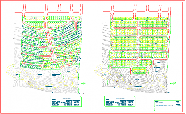
This architectural CAD drawing illustrates a comprehensive small town planning layout focused on sustainable land planning and 2D urban design principles. The file includes precisely measured road networks, residential plot divisions, contour mapping, and detailed topography. Designed for efficient infrastructure integration, it provides a clear visualization of how land, roadways, and open spaces interact within a compact community layout. The plan is ideal for analyzing site elevation and optimizing spatial organization for town planning professionals.
The CAD layout serves as a valuable design reference for architects, civil engineers, and urban planners working on small-scale residential or township development projects. The drawing demonstrates sustainable land utilization, functional zoning, and efficient infrastructure placement. Suitable for use with AutoCAD, Revit, or SketchUp, this architectural CAD drawing allows users to explore terrain coordination and design adaptability. It is a complete representation of small town planning that promotes eco-friendly, organized, and smart community growth.

Uploaded by:
Jafania Waxy
Tags
Ratings & Reviews
Be the first to share your experience with this product. Your review helps others make better decisions!