Goiânia city map DWG with complete road network and urban details
Description
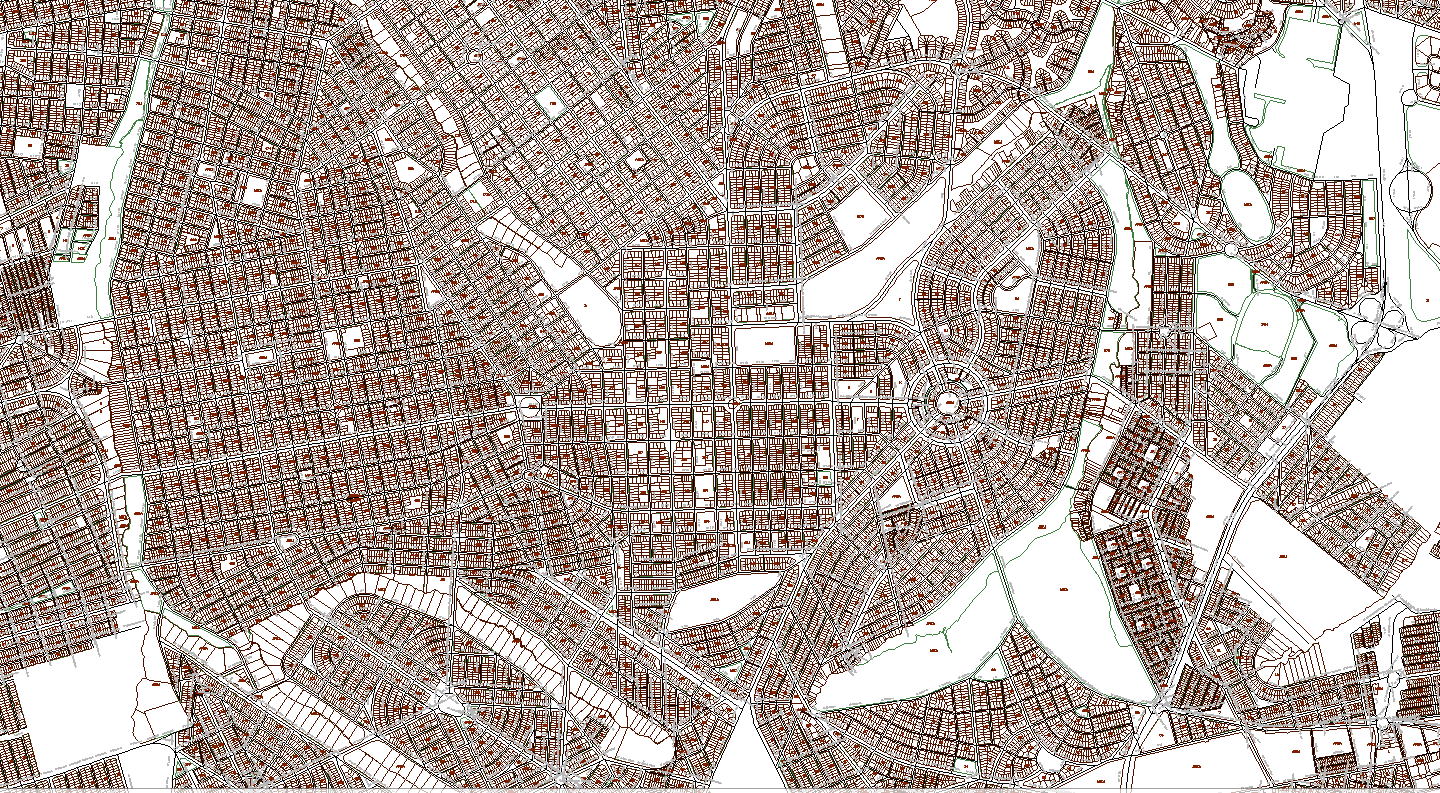
This detailed Goiânia city map DWG provides a full urban layout including major roads, secondary streets, blocks, divisions, green areas, and land distribution patterns. The drawing captures the city’s structured grid, radial avenues, roundabouts, neighborhood zoning, and circulation routes with high drafting accuracy. Each sector is clearly defined, making it a valuable reference for professionals working on urban planning, mobility analysis, transportation design, and infrastructure studies.
The DWG file also includes parcel outlines, landscape pockets, community blocks, and the geometric geometry of intersections and public spaces. With its precise representation of the city’s form, the map allows architects, civil engineers, planners, and CAD users to conduct analysis, prepare proposals, and carry out large-scale design work. This downloadable AutoCAD map serves as a reliable foundation for development strategies, master planning, city modeling, and GIS-based enhancements. The file is ideal for professionals needing accurate location mapping, road hierarchy study, or urban expansion assessment.
File Type:
DWG
File Size:
95.3 MB
Category::
Urban Design
Sub Category::
Town Design And Planning
type:
Free

Uploaded by:
Jafania
Waxy