Town Planning DWG with Site Layout Roads Structures and Zones
Tags
Ratings & Reviews
Be the first to share your experience with this product. Your review helps others make better decisions!
Description
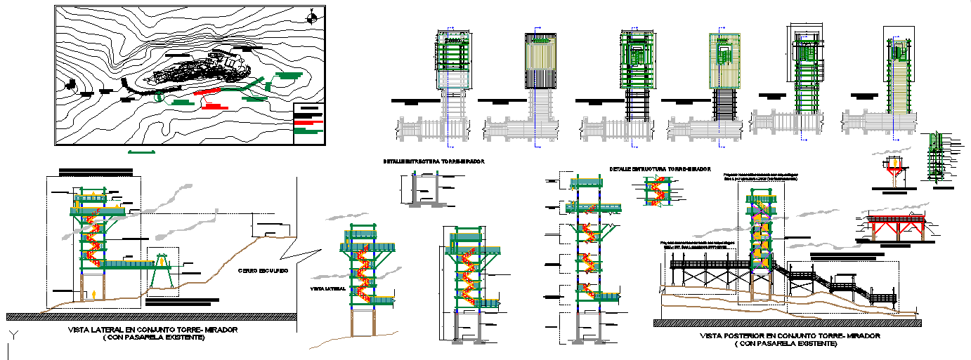
This Town Planning Design DWG presents a detailed site layout showing structural zones, contour mapping, walkways, viewing towers, platforms, access routes, and landscape connections. The plan highlights a small land development area marked for multiple uses such as building, gardening, and recreational functions. It includes topographic lines, slope directions, retaining paths, and structural nodes that guide movement throughout the site. The drawing also features structural tower sections, stair details, elevation profiles, support foundations, and walkway alignments designed for safe circulation.
The file further includes architectural elevations showing vertical tower structures, interconnected ramps, support beams, and protective railings. The sectional drawings illustrate how each platform connects to the surrounding landscape, ensuring stability and visibility for observation points. This DWG is useful for planners, architects, and engineers who require a complete town planning layout with clear divisions for amenities like swimming pools, club house, restaurant zones, garden areas, and bungalow plots. The combination of contour plans, structural details, and elevation drawings makes it suitable for concept development, site analysis, and detailed project execution.

Uploaded by:
Jafania Waxy
Tags
Ratings & Reviews
Be the first to share your experience with this product. Your review helps others make better decisions!