City Town Planning Layout Drawing With Roads Blocks And Zones

Ratings & Reviews
Be the first to share your experience with this product. Your review helps others make better decisions!
Description
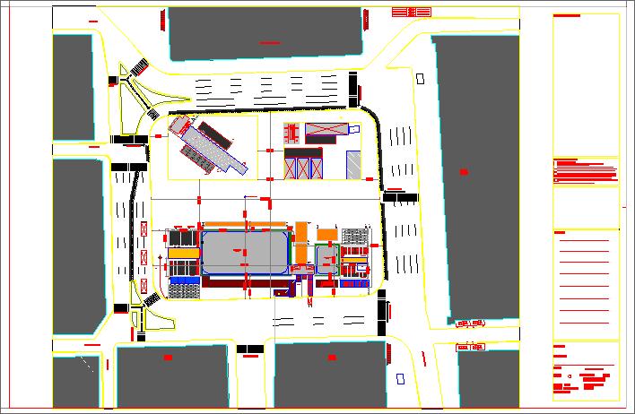
This city town planning drawing presents a detailed urban layout plan showing road networks land parcels blocks and zoning distribution for organized city development. The drawing illustrates primary and secondary roads with approximate widths of 12 m and 9 m including junction planning circulation paths parking areas and plot demarcation for efficient traffic movement. Building blocks are clearly arranged with setback spacing open areas and service access to support residential commercial and public use planning. The town planning layout drawing also highlights infrastructure coordination zones boundary limits and access connections suitable for large scale city planning projects. This AutoCAD DWG file is useful for city planning authorities architects and civil engineers involved in urban layout design town planning layout preparation and city development planning using accurate scaled drawings.
Tags
Uploaded by:
Harriet
Burrows
Ratings & Reviews
Be the first to share your experience with this product. Your review helps others make better decisions!