Town Planning Design in AutoCAD with Urban Layout and Measurements
Tags
Ratings & Reviews
Be the first to share your experience with this product. Your review helps others make better decisions!
Description
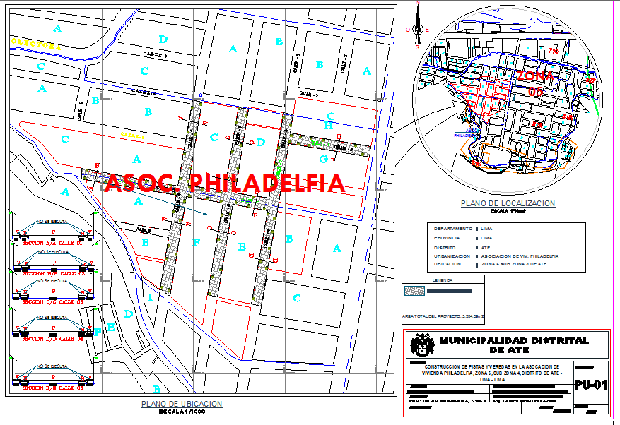
Download the Town Planning Design in AutoCAD format, providing a clear and well-structured urban layout prepared for planned development projects. This drawing illustrates organized land use planning with defined zones for residential plots, public spaces, internal roads, green areas, and utility circulation. Accurate measurements and layout clarity help explain how land parcels are arranged to support accessibility, public welfare, and efficient movement within the urban environment. The plan supports architects and civil engineers in understanding spatial relationships, plot distribution, and functional zoning required for town planning projects.
The AutoCAD town planning drawing follows standard urban planning principles focused on land use control, environmental consideration, and organized development. It supports coordination between built areas and open spaces while maintaining proper road networks and public zones. Compatible with AutoCAD, Revit, and Google SketchUp, this file focuses strictly on town planning layout details, measurements, and drawing accuracy. It provides reliable and professional documentation suitable for urban development planning, residential township design, and public infrastructure coordination.

Uploaded by:
Jafania Waxy
Tags
Ratings & Reviews
Be the first to share your experience with this product. Your review helps others make better decisions!