Topographical Contour Mapping DWG with Area and Landscaping Details
Tags
Ratings & Reviews
Be the first to share your experience with this product. Your review helps others make better decisions!
Description
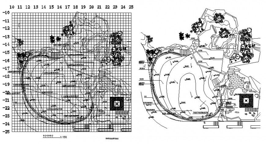
Enhance your architectural and civil engineering projects with this Topographical Contour Mapping DWG file. The drawing provides complete contour lines with numbering, elevation details, and landscaping features, allowing architects, engineers, and designers to accurately visualize the terrain of any site. This DWG file includes detailed topographical area layouts, slopes, gradient measurements, and plot divisions, making it ideal for planning landscaping, construction, and urban development projects. Professionals can use this file in AutoCAD, 3D Max, Revit, or SketchUp for precise terrain mapping and site analysis.
The DWG also features detailed sectional contour views, spot elevations, and grid references to ensure accurate representation of the terrain. With complete topographical measurements, contour lines, and landscaping specifications, this file provides all the necessary details for site planning, construction, and landscape design. The Topographical Contour Mapping DWG ensures accurate project execution, reduces errors, and allows professionals to plan construction or landscaping projects efficiently, saving time and resources while maintaining precise site layouts.
Uploaded by:
Eiz Luna
Tags
Ratings & Reviews
Be the first to share your experience with this product. Your review helps others make better decisions!