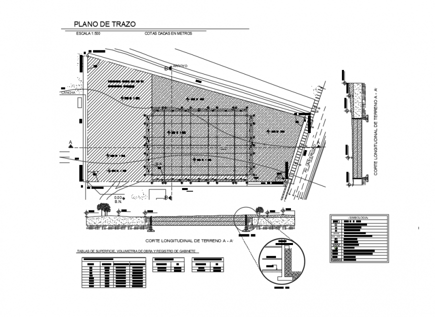
Longitudinal cutting of land and site plan details dwg file
Ratings & Reviews
⭐
No Reviews Yet
Be the first to share your experience with this product. Your review helps others make better decisions!
★★★★★
Description
Longitudinal cutting of land and landscaping details that includes a detailed view of tracing plane scale 1: 500 levels given in meters, totall surface, occupied surface, stream, surface tables, work volumetry and cabinet registration, earth, compacted, symbology details and much more of landscaping details.
File Type:
DWG
File Size:
3.4 MB
Category::
Urban Design
Sub Category::
Architecture Urban Projects
type:
Gold
Tags
#site plan#site plan dwg file#site plan details#site plan plan#site plan layout#site plan design#site plan project
Uploaded by:
Eiz
Luna
Ratings & Reviews
⭐
No Reviews Yet
Be the first to share your experience with this product. Your review helps others make better decisions!
★★★★★