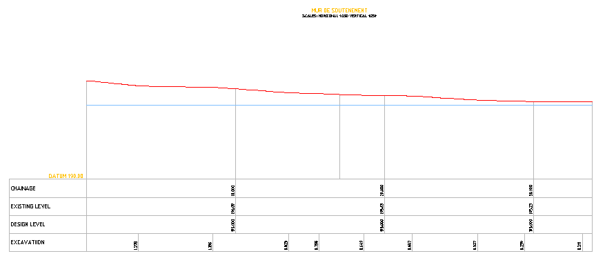
Road Profile Drawing Showing Existing And Design Level Datum 190
Tags
Ratings & Reviews
Be the first to share your experience with this product. Your review helps others make better decisions!
Description
This civil road profile autocad drawing presents a detailed road profile drawing that illustrates the relationship between ground level and proposed construction levels for roadway planning. The layout clearly shows the roadway's existing and design level profile aligned with a defined datum 190 reference, helping engineers understand elevation variation across the alignment. The drawing includes segmented station points where ground-level readings and design-level layout values are compared to determine excavation and filling requirements along the route. Vertical grid divisions represent measured distances while level indicators provide accurate elevation information essential for roadway grading and construction preparation.
Uploaded by:
viddhi chajjed
Tags
Ratings & Reviews
Be the first to share your experience with this product. Your review helps others make better decisions!