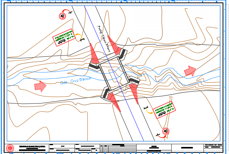
Bridge Location Plan Across River Contour Survey Layout Design
Tags
Ratings & Reviews
Be the first to share your experience with this product. Your review helps others make better decisions!
Description
Bridge location plan across river with contour survey layout showing the engineering planning and site positioning of a bridge crossing over a natural water channel. The drawing illustrates a detailed bridge location plan integrated with topographic contour lines representing the natural terrain levels surrounding the river crossing. The layout clearly identifies the bridge alignment across the river, the road connection approach, and the placement of bridge abutments positioned on both sides of the riverbank. Contour survey lines provide elevation references that help engineers understand the terrain slope, water flow direction, and ground formation near the bridge construction area. The plan also shows river path alignment and roadway connectivity, which assists in evaluating the best structural placement for the bridge span.
Uploaded by:
viddhi chajjed
Tags
Ratings & Reviews
Be the first to share your experience with this product. Your review helps others make better decisions!