Topographic Site Plan DWG with Road Alignment and River Details
Tags
Ratings & Reviews
Be the first to share your experience with this product. Your review helps others make better decisions!
Description
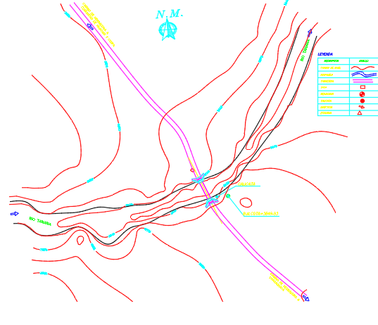
This AutoCAD DWG file provides a detailed topographic site plan showing precise contours, river alignment, and road layouts. It includes elevation lines, water flow directions, and marked points of interest, offering a comprehensive view of the terrain for planning and design purposes. The plan highlights topography, natural features, and infrastructure intersections, making it suitable for civil engineers, architects, and planners working on site development, roadway construction, or environmental assessment projects. Each contour and alignment is clearly annotated, allowing for accurate measurements and site analysis.
Uploaded by:
viddhi chajjed
Tags
Ratings & Reviews
Be the first to share your experience with this product. Your review helps others make better decisions!