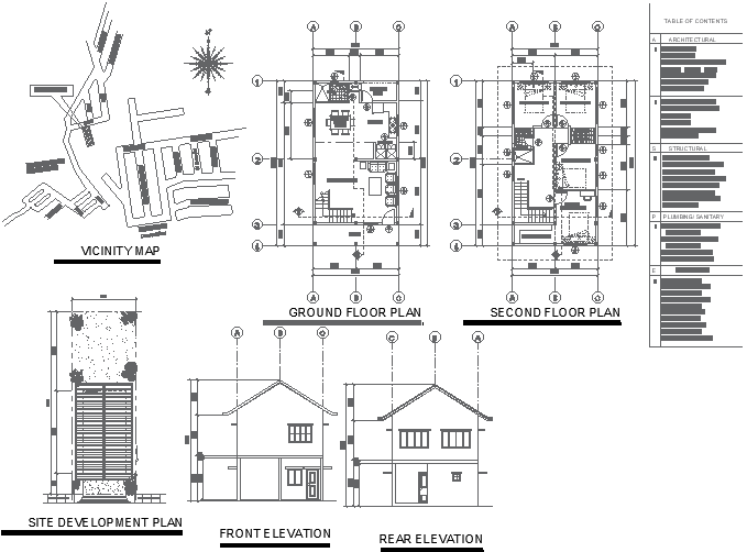
Vicinity Map with Site Development and Floor Plan in AutoCAD drawing
Tags
Ratings & Reviews
Be the first to share your experience with this product. Your review helps others make better decisions!
Description
This AutoCAD DWG file provides a comprehensive overview of a project's layout, including a vicinity map, site development plan, and detailed floor plans for both the first and second floors. The drawing offers clear elevation views, ensuring a thorough understanding of the site's surroundings and the proposed development. Ideal for architects, urban planners, and developers, this CAD file aids in visualizing the overall project and its integration into the existing environment. The detailed plans and elevations ensure clarity and accuracy in your project visualization.

Uploaded by:
Liam White
Tags
Ratings & Reviews
Be the first to share your experience with this product. Your review helps others make better decisions!